|
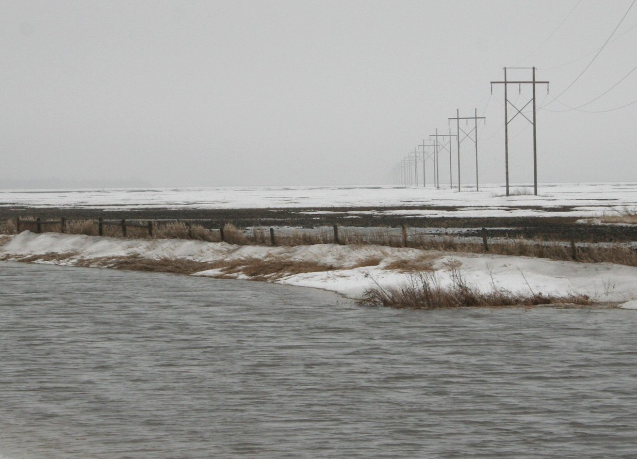
March 12: Red River Valley, north of Argusville, ND. Onto one of the flattest surfaces on Earth, warm rains begin to convert the thick winter's snowfall into what will be soon be a vast sheet of water. The flood is beginning . . .
© Donald Schwert
|

|
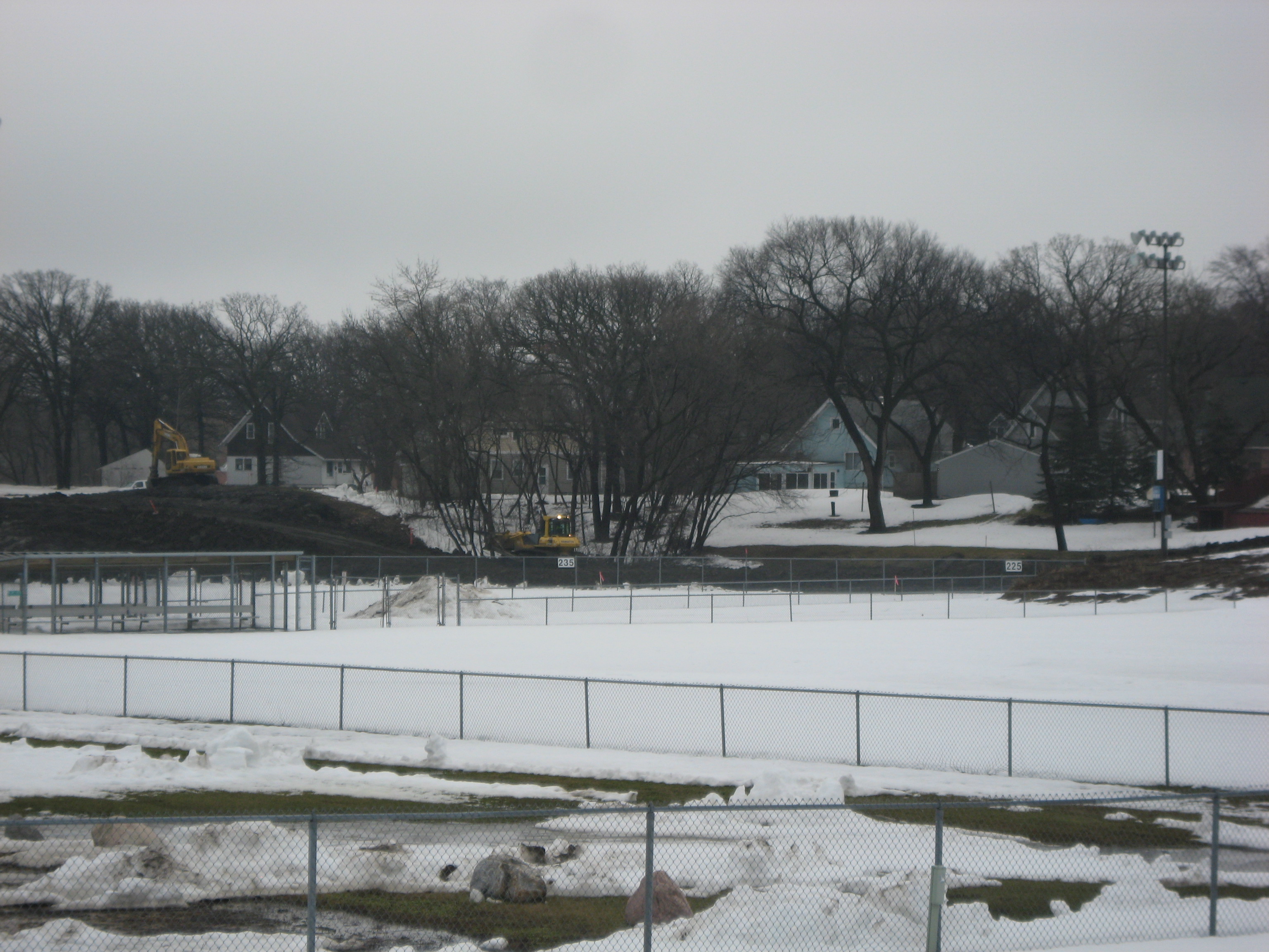
March 13: Construction progresses for a massive permanent dike along the southeast portion of Mikkelson Field in north Fargo.
© Marty Hoag
|

|
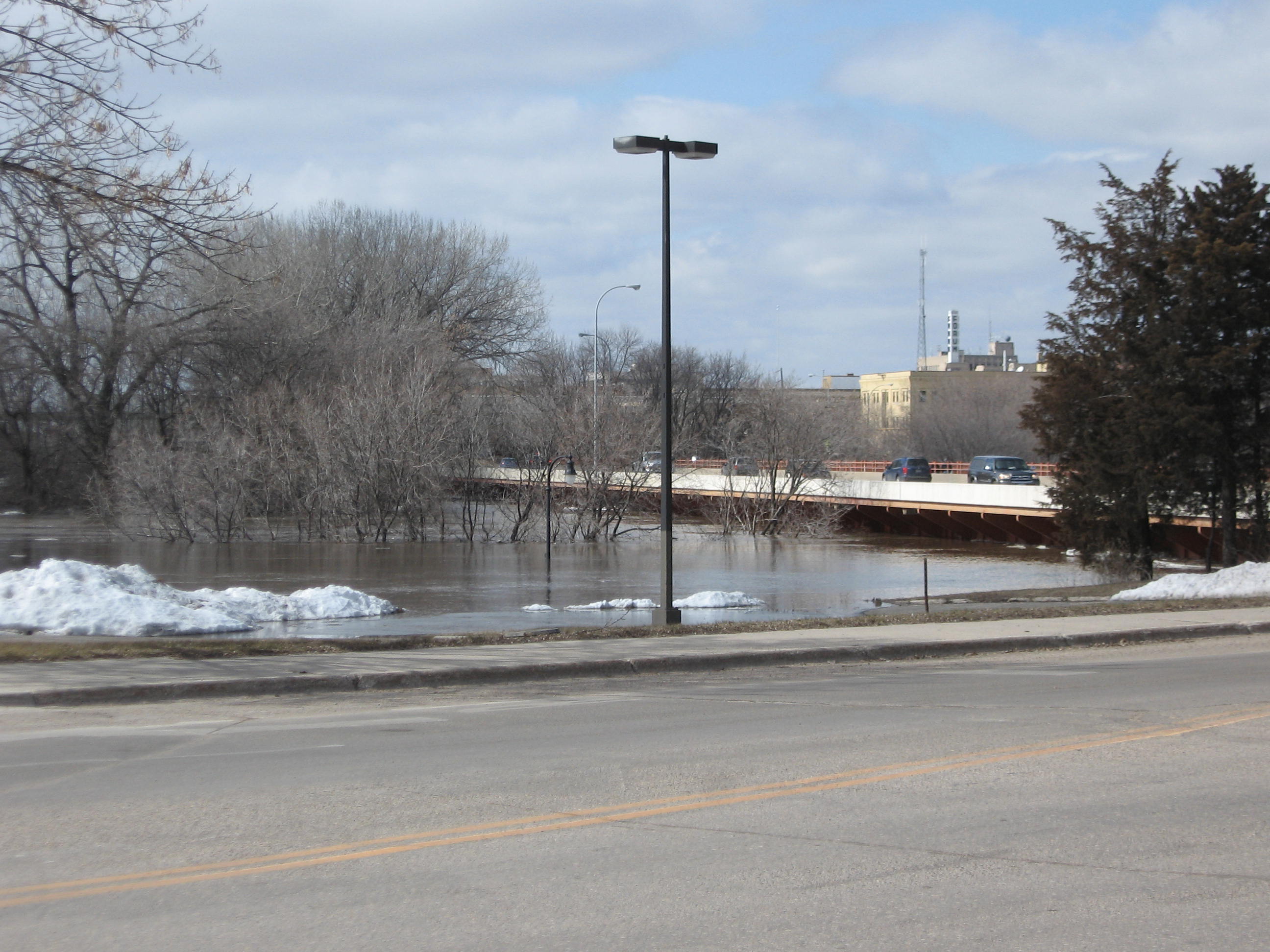
March 13: At about midnight last night, the Red River officially entered into flood stage (18'). A sure sign of this is water rising across Elm Street N at El Zagal Golf Course. Red River stage (at Fargo): 18.7'.
© Donald Schwert
|

|
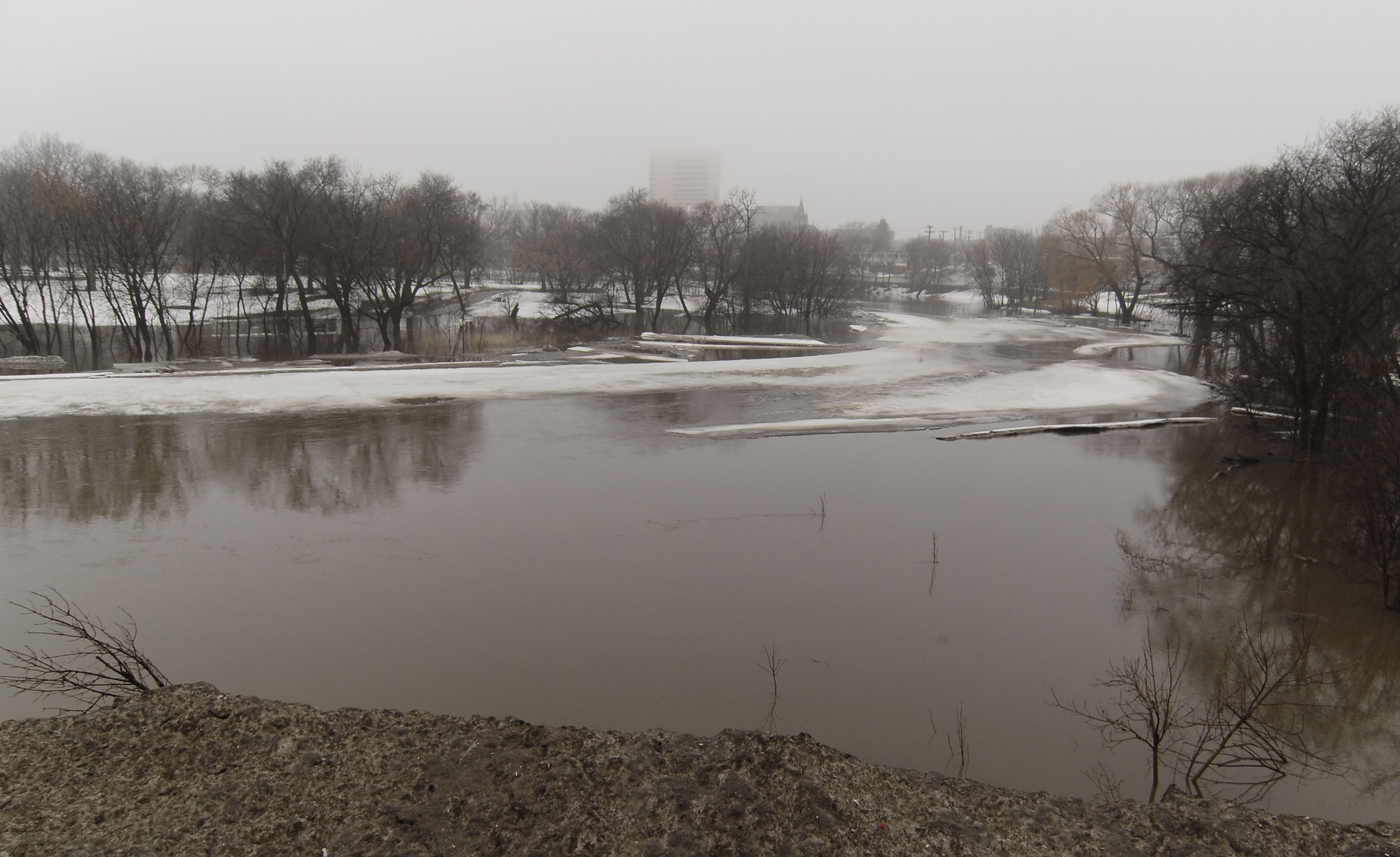
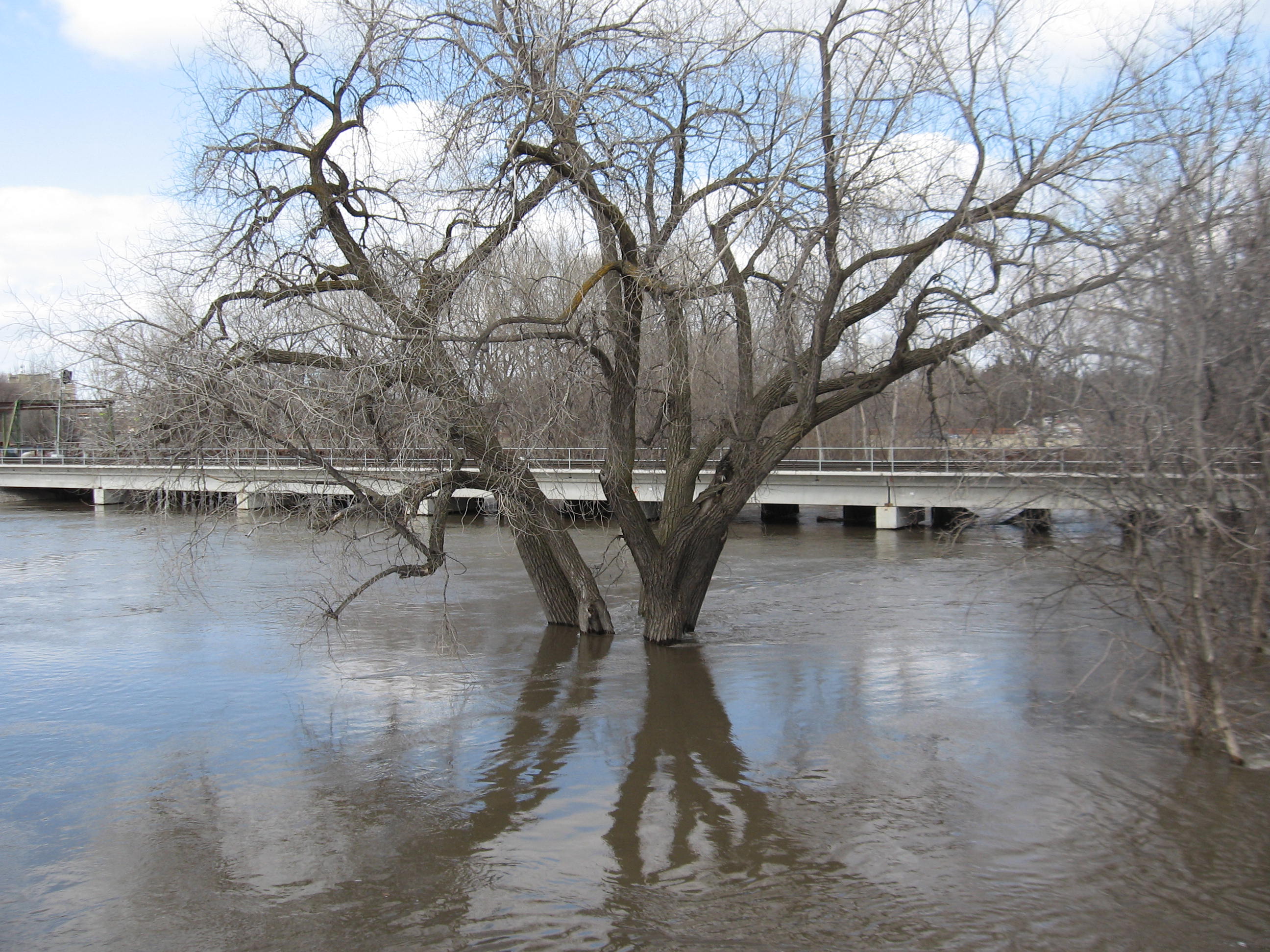
March 13: Photo #1 of a 3-day sequence of flood development. Red River, viewed south toward downtown Fargo. Red River stage (at Fargo): 18.7'.
© Daniel Reetz
|

|
March 14: Photo #2 of a 3-day sequence of flood development. Red River, viewed south toward downtown Fargo. Red River stage (at Fargo): 22.5'.
© Daniel Reetz
|

|
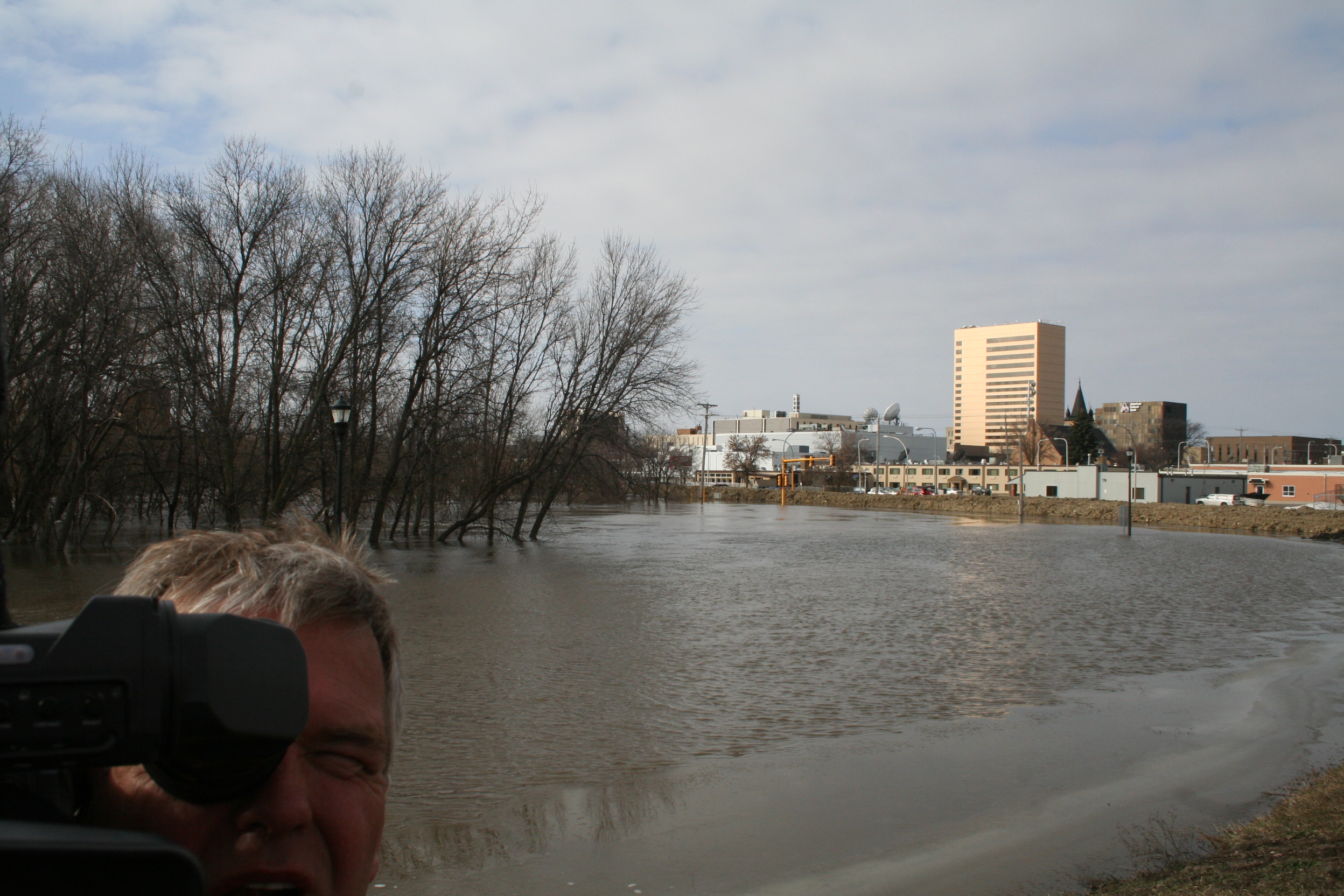
March 15: Photo #3 of a 3-day sequence of flood development. Red River, viewed south toward downtown Fargo. Red River stage (at Fargo): 25.0'.
© Daniel Reetz
|

|
March 15: Construction begins for a temporary dike along 2nd Street N in downtown Fargo. Red River stage (at Fargo): 25.3'.
© Donald Schwert
|

|
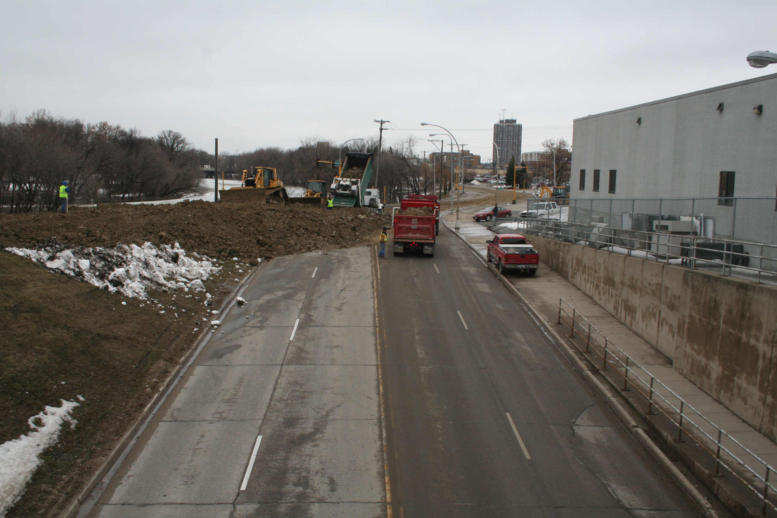
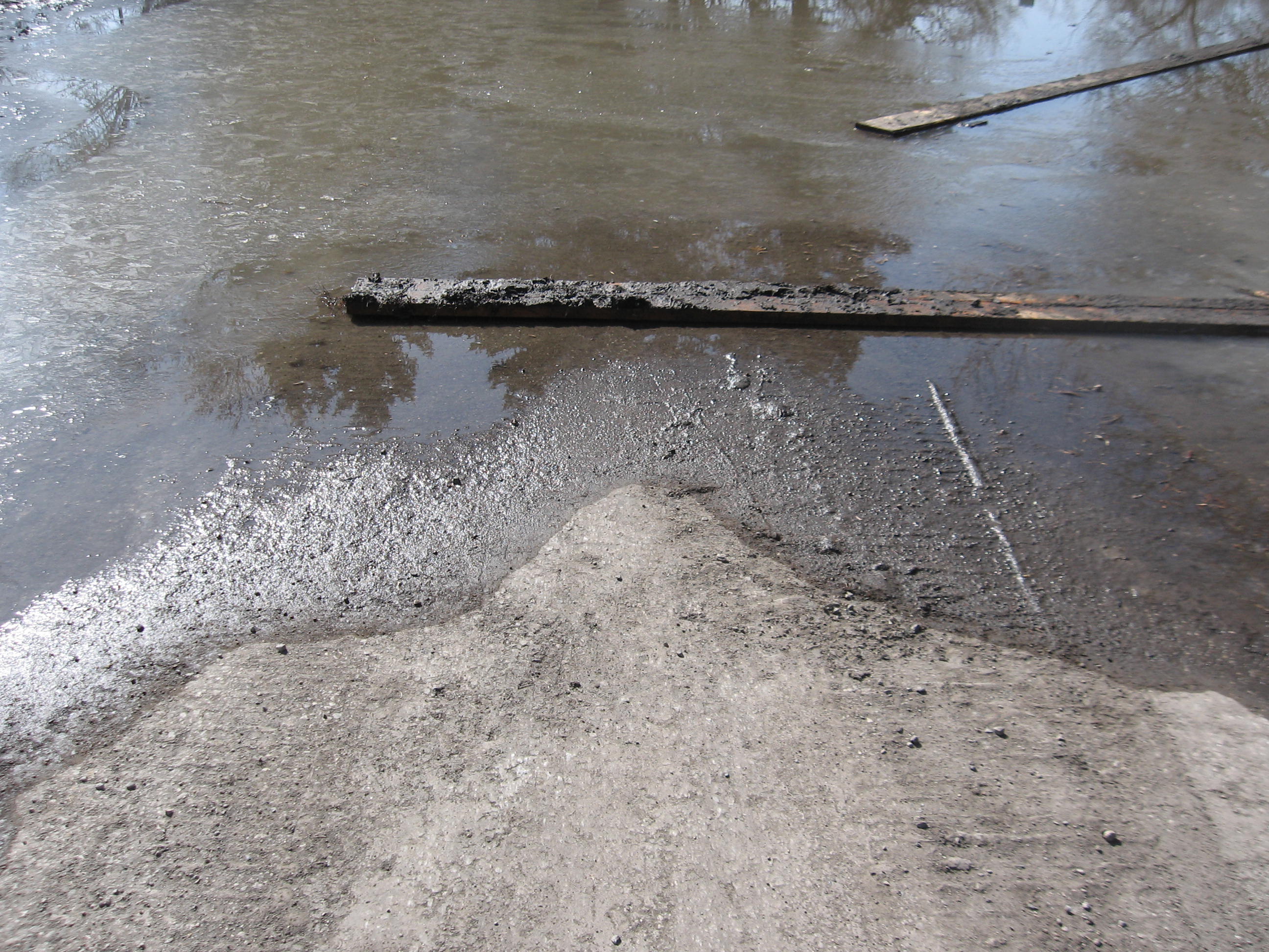
March 15: The asphalt pavement of a parking lot yields under the weight of emergency equipment, as thawing soils turn to mud.
© Donald Schwert
|

|
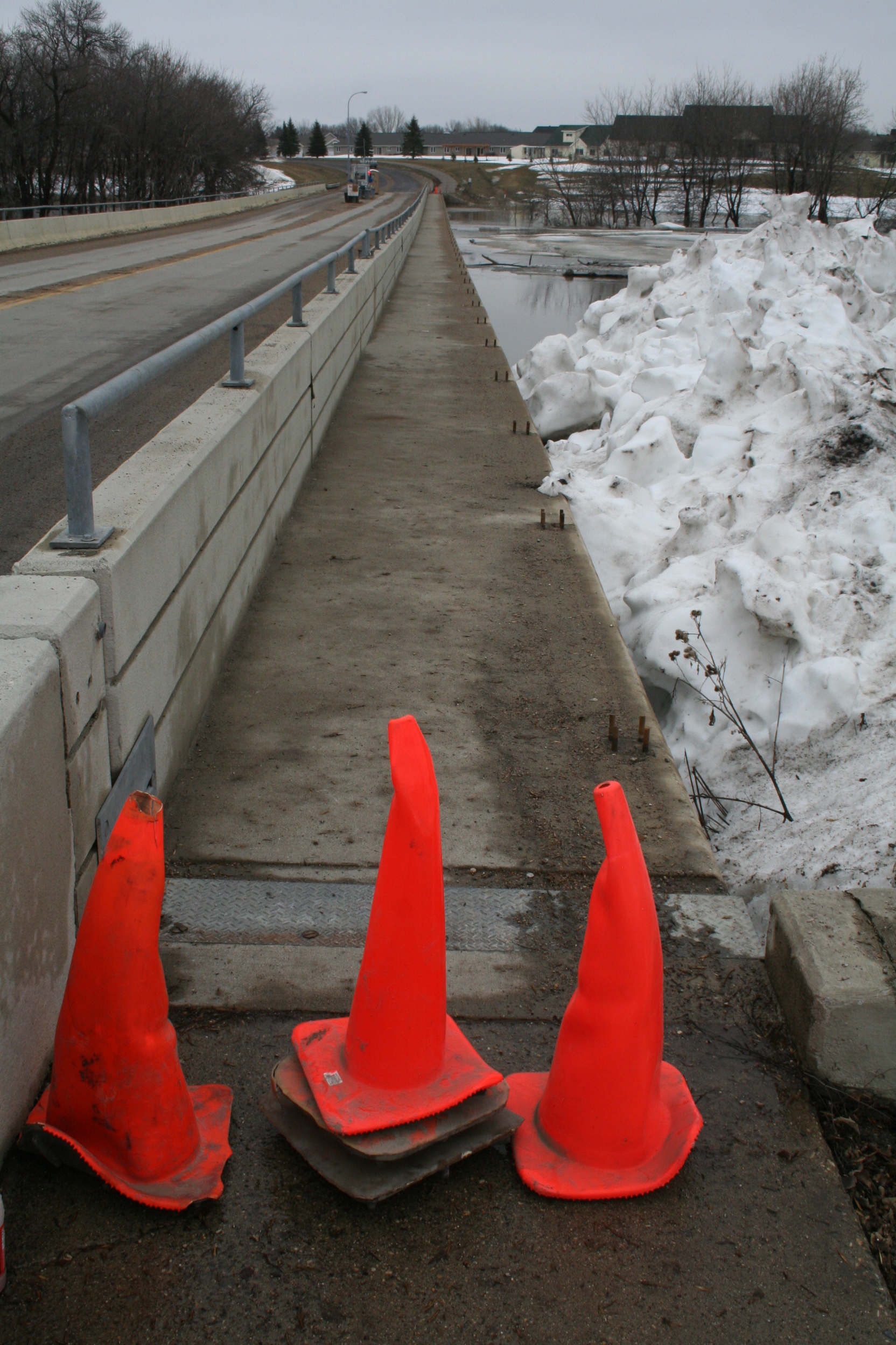
March 15: Three bruised coneheads faithfully fend off any pedestrians attempting to walk onto the 12th Ave. N. toll bridge. Red River stage (at Fargo): 25.3'.
© Donald Schwert
|

|
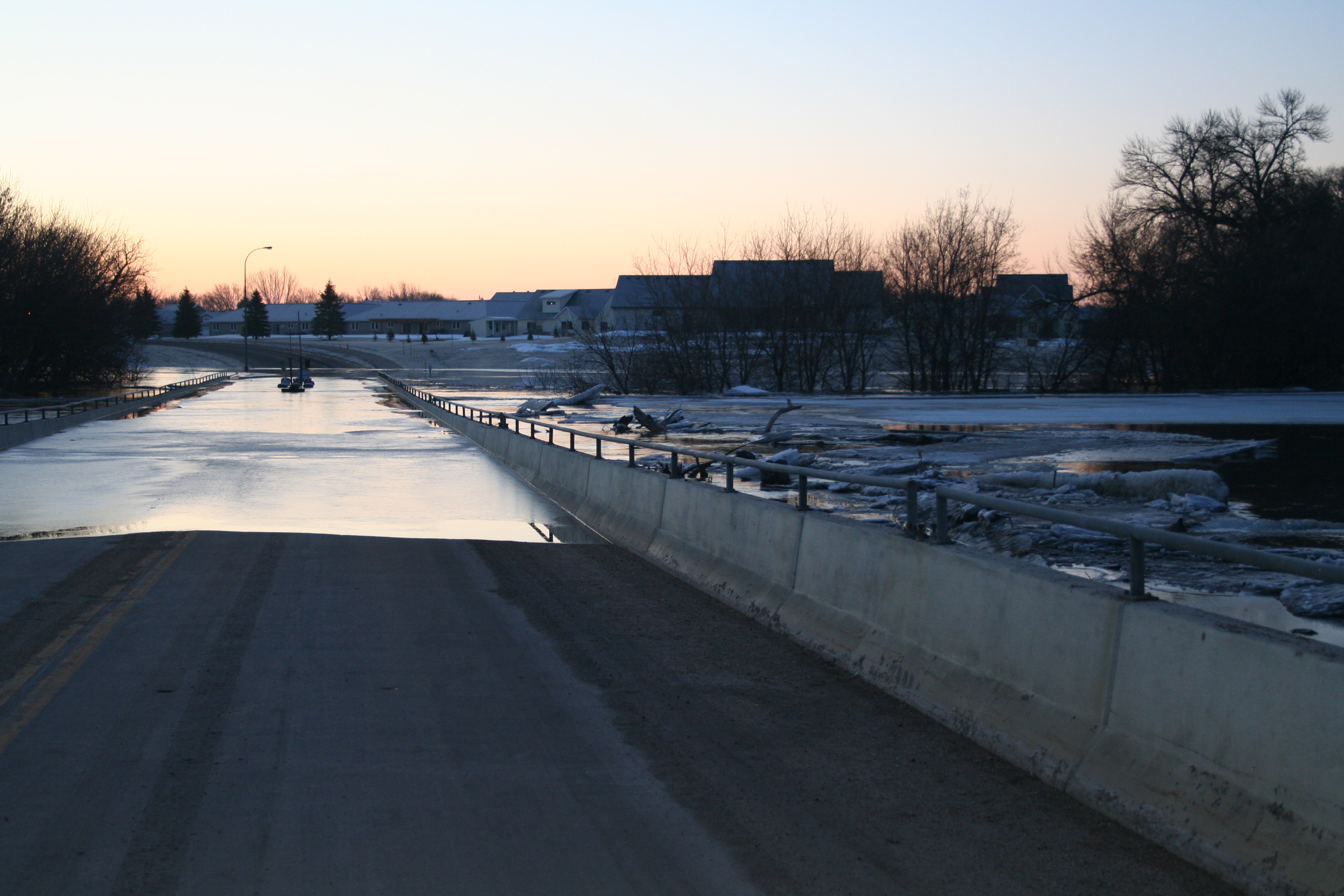
March 17: Sunrise, as the river officially enters into "major flood" stage (30'). Ice, logs, and debris start to jam on the upstream side of the 12th Ave. toll bridge. This photo shows why this "floodable" bridge is an ill-conceived structure, acting to impede water and ice movement during times of flooding. Red River stage (at Fargo): 30.4'.
© Donald Schwert
|

|
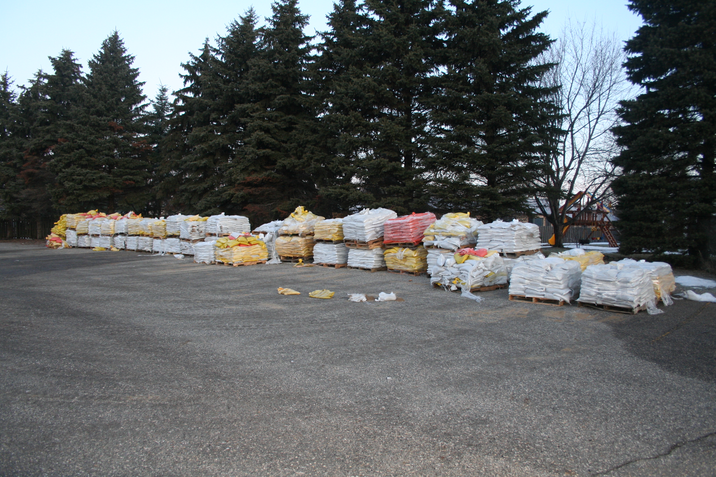
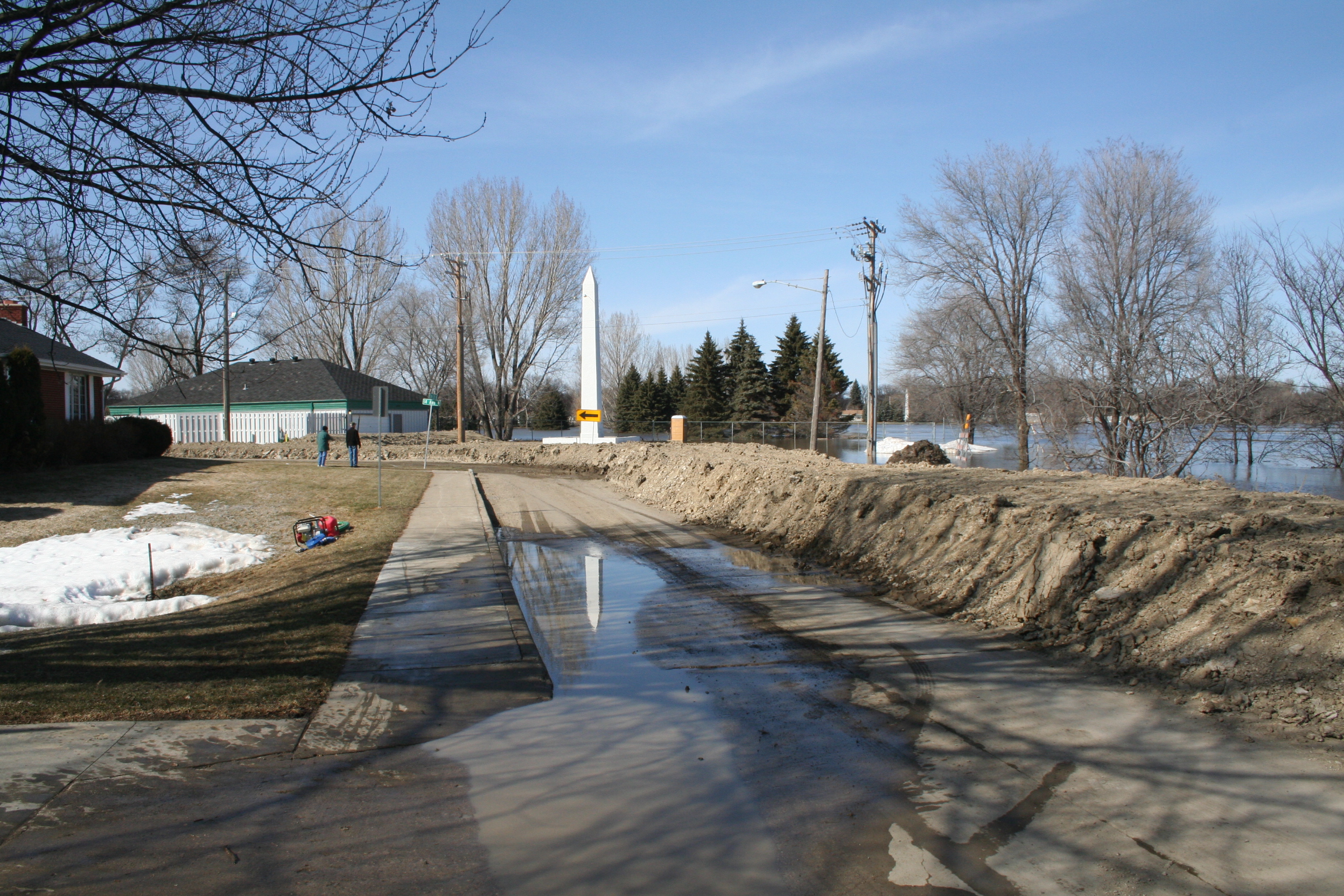
March 17: During the previous evening, palettes of sandbags were delivered into this north Fargo residential neighborhood.
© Donald Schwert
|

|
March 18: A temporary clay dike is completed along 14th Ave N, at the southeast edge of El Zagal Golf Course.
© Donald Schwert
|

|
March 18: Jack Williams Stadium, 12th Ave. N and Elm St. N. Great seats are available today, if a scuba ball game should develop! Red River stage (at Fargo): 33.6'.
© Donald Schwert
|

|
March 18: A temporary clay dike is placed atop Oak St. N at Mikkelson Field. Red River stage (at Fargo): 33.6'.
© Donald Schwert
|

|
March 18: The temporary dike atop 2nd Street N in downtown Fargo is now complete. Red River stage (at Fargo): 33.6'.
© Donald Schwert
|

|
March 18: Downtown Fargo, from the "river" side of the temporary dike atop 2nd Street N. Red River stage (at Fargo): 33.6'.
© Donald Schwert
|

|
March 18: By about 5:00 pm, waters begin to spill over the dike at El Zagal Golf Course. Poorly-conceived dikes such as this only serve to inhibit flood storage capacity. Red River stage (at Fargo): 34.0'.
© Donald Schwert
|

|
March 18: By about 5:00 pm, waters begin to spill over the dike at El Zagal Golf Course. Poorly-conceived dikes such as this only serve to inhibit flood storage capacity. Red River stage (at Fargo): 34.0'.
© Donald Schwert
|

|
March 18: (Large file). Panorama of flood from region of 6th Ave. N, Fargo, ND.
© Daniel Reetz
|

|
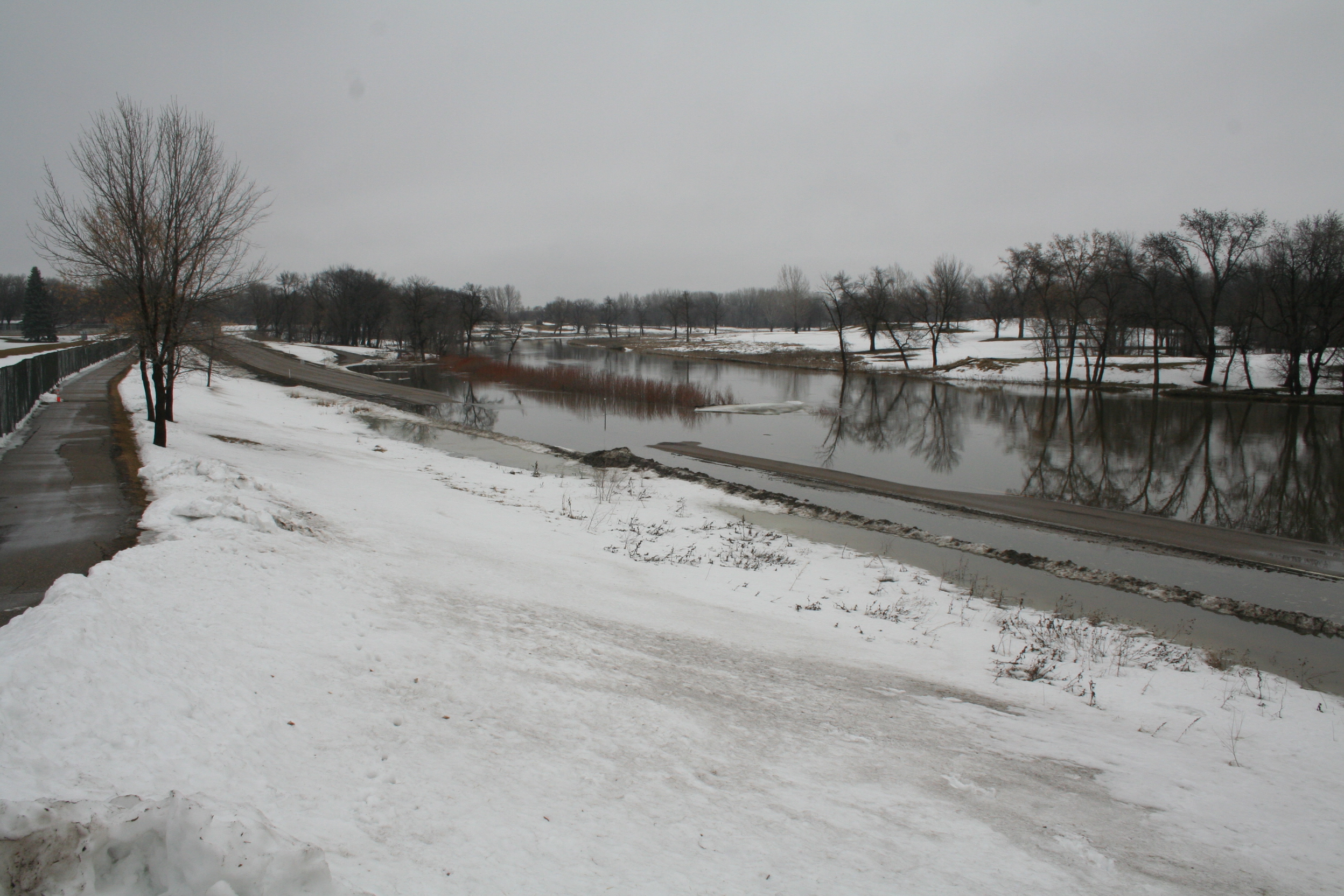
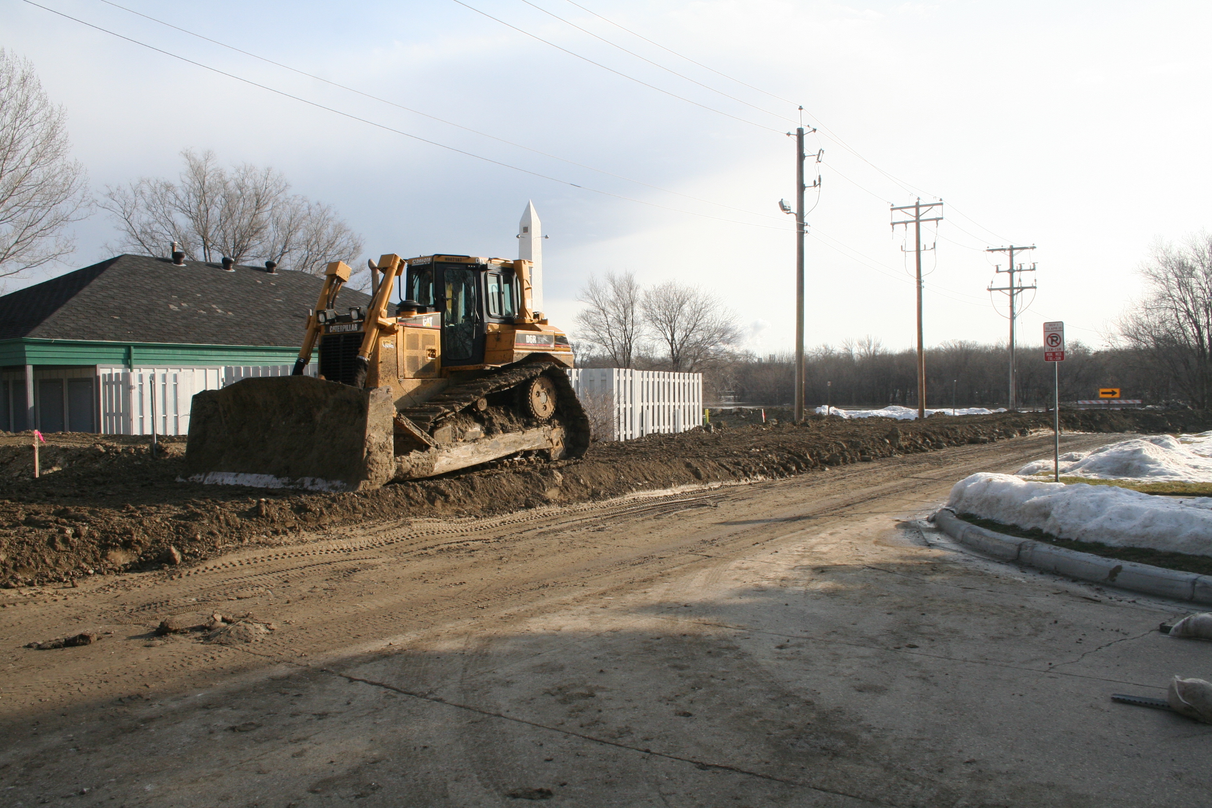
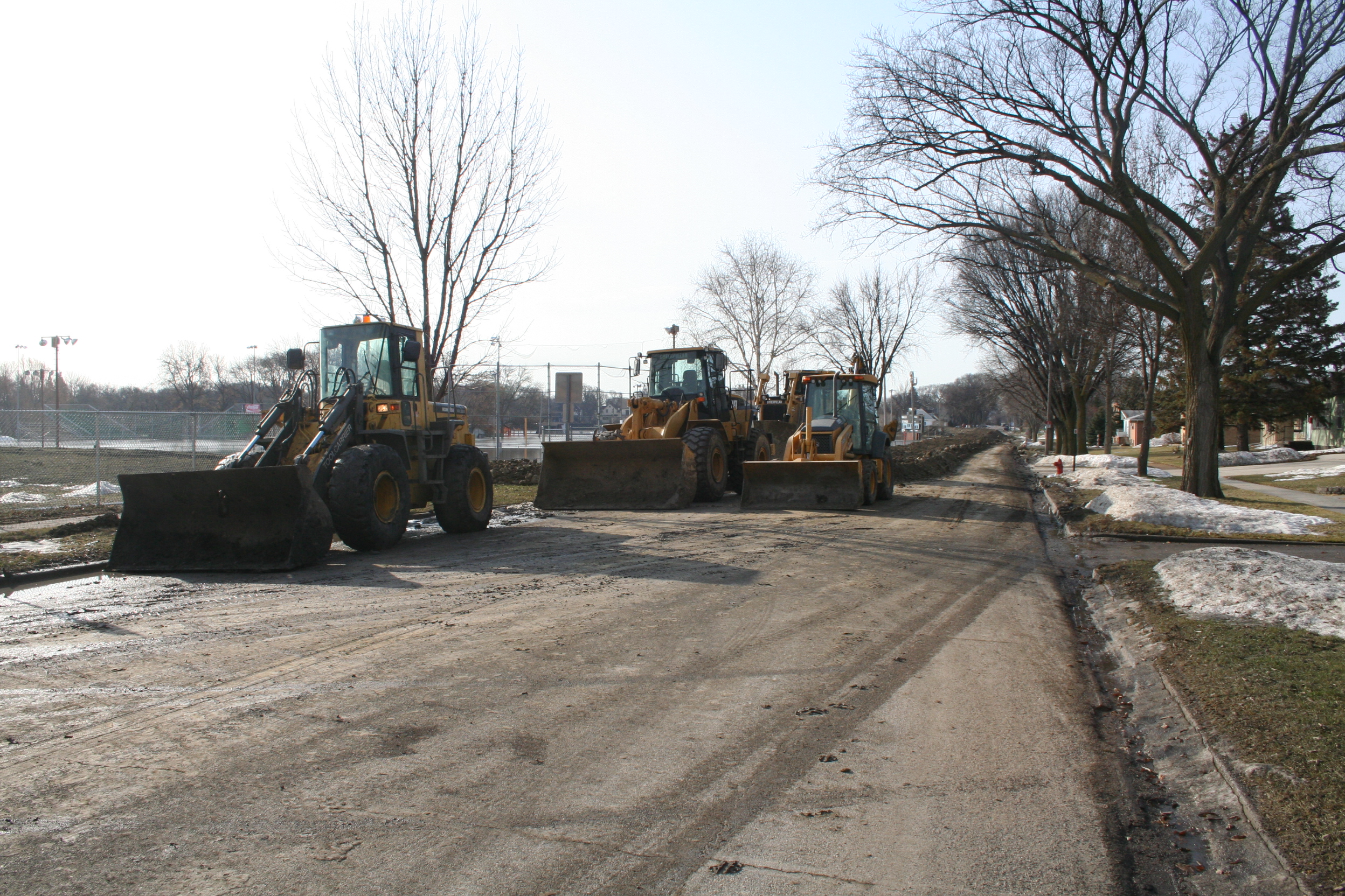
March 19: Temporary earthen dike on Oak Street N, Fargo, ND.
© Daniel Reetz
|

|
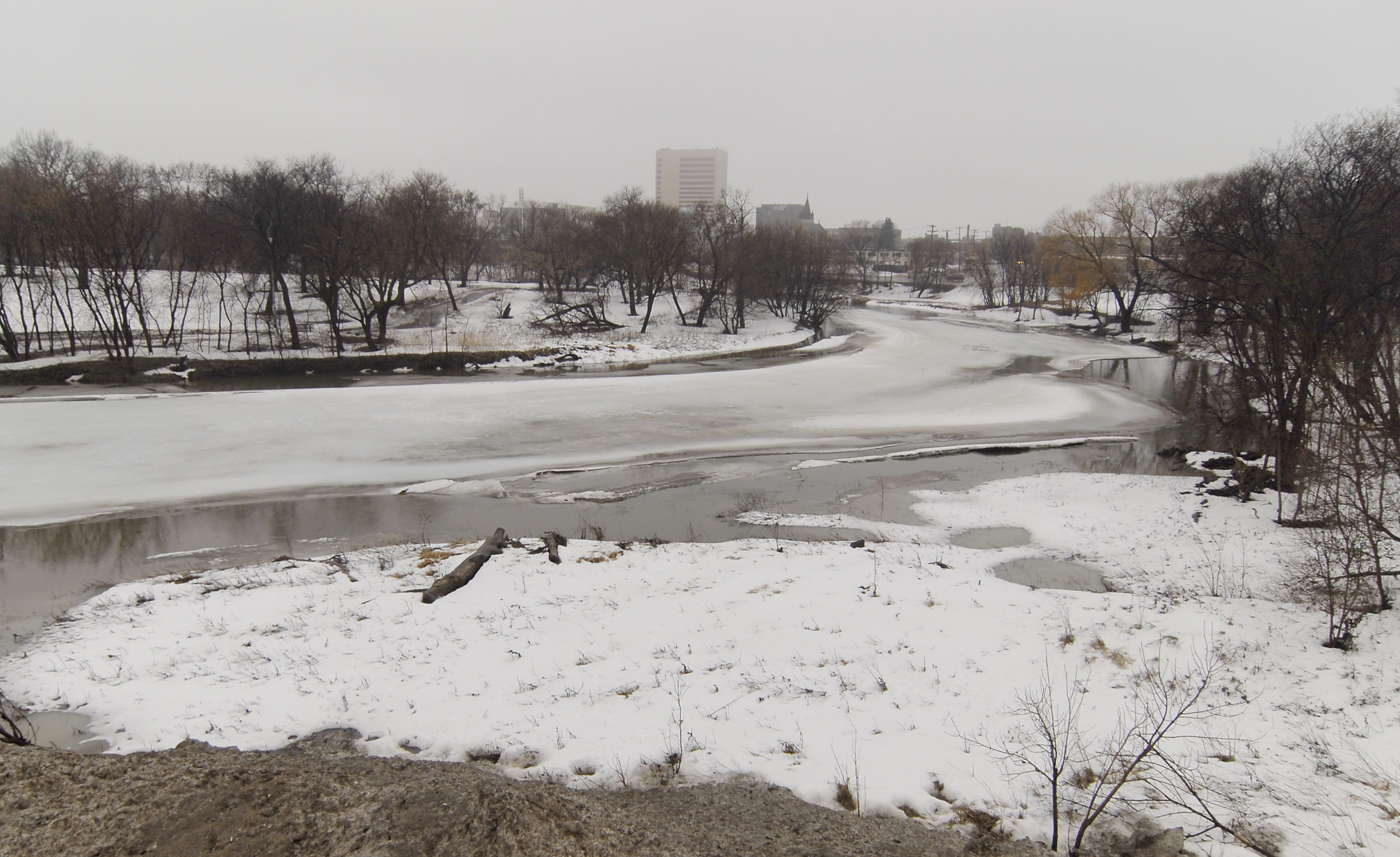
March 20: View onto downtown Fargo. Red River stage (at Fargo): 36.5'.
© Donald Schwert
|

|
March 20: The photographer of the previous photo is himself photographed by an ABC News Crew.
© Donald Schwert
|

|
March 20: View eastward from Fargo toward the (drowned) 12th Ave. N. toll bridge. Red River stage (at Fargo): 36.5'.
© Donald Schwert
|

|
March 20: View to northeast from the Main Avenue bridge, Moorhead, Minnesota. Red River stage (at Fargo): 36.6'.
© Larry Hansen
|

|
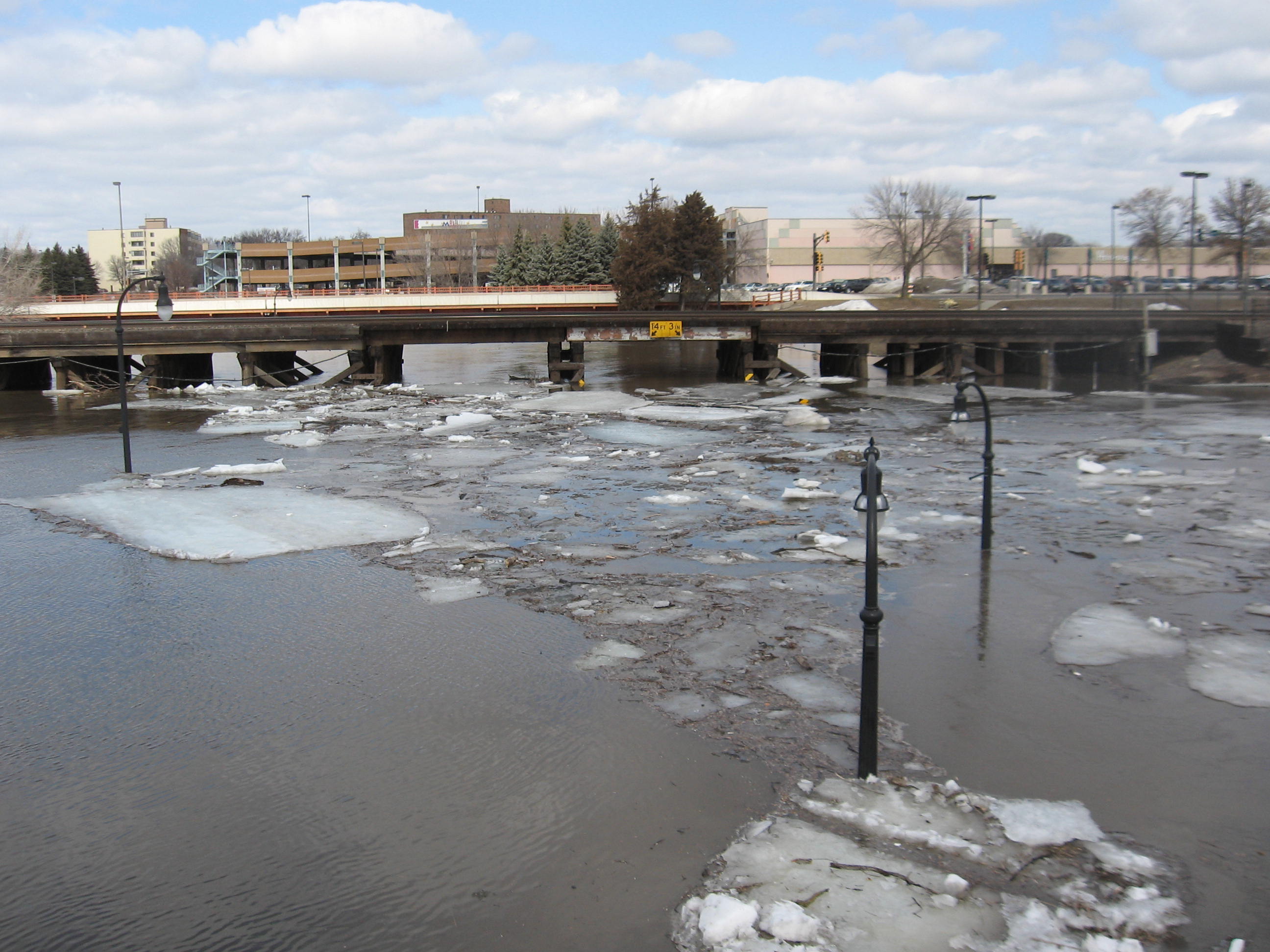
March 20: Burlington-Northern railroad bridge, Moorhead, Minnesota. Red River stage (at Fargo): 36.6'.
© Larry Hansen
|

|
March 20: Red River, Moorhead, Minnesota. Red River stage (at Fargo): 36.6'.
© Larry Hansen
|

|
March 20: View northeastward toward Fargo, from Moorhead, Minnesota. Red River stage (at Fargo): 36.6'.
© Larry Hansen
|

|
March 21: Elm Street at 14th Ave. N at flood crest. Red River stage (at Fargo): 36.99'.
© Donald Schwert
|

|
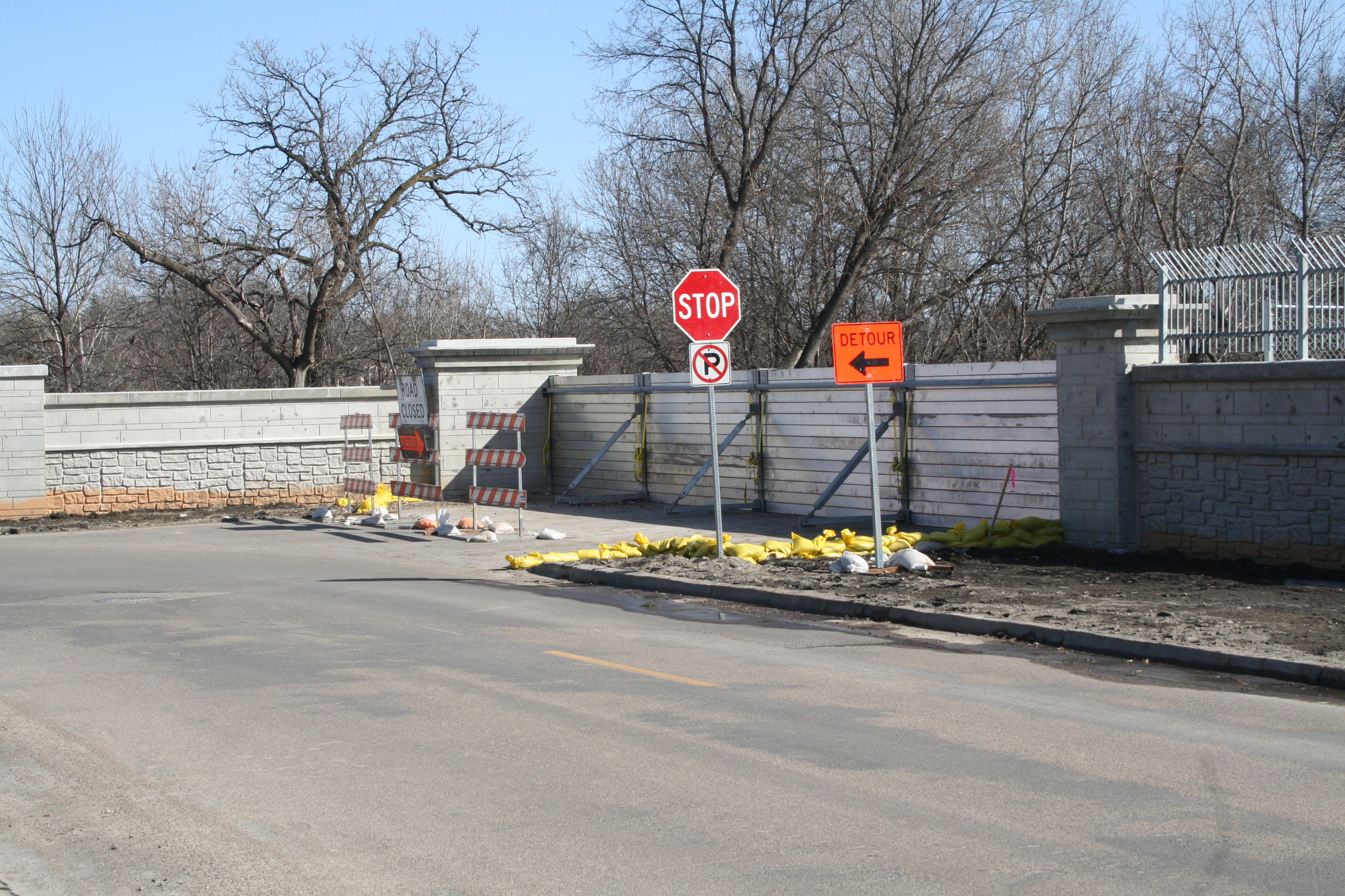
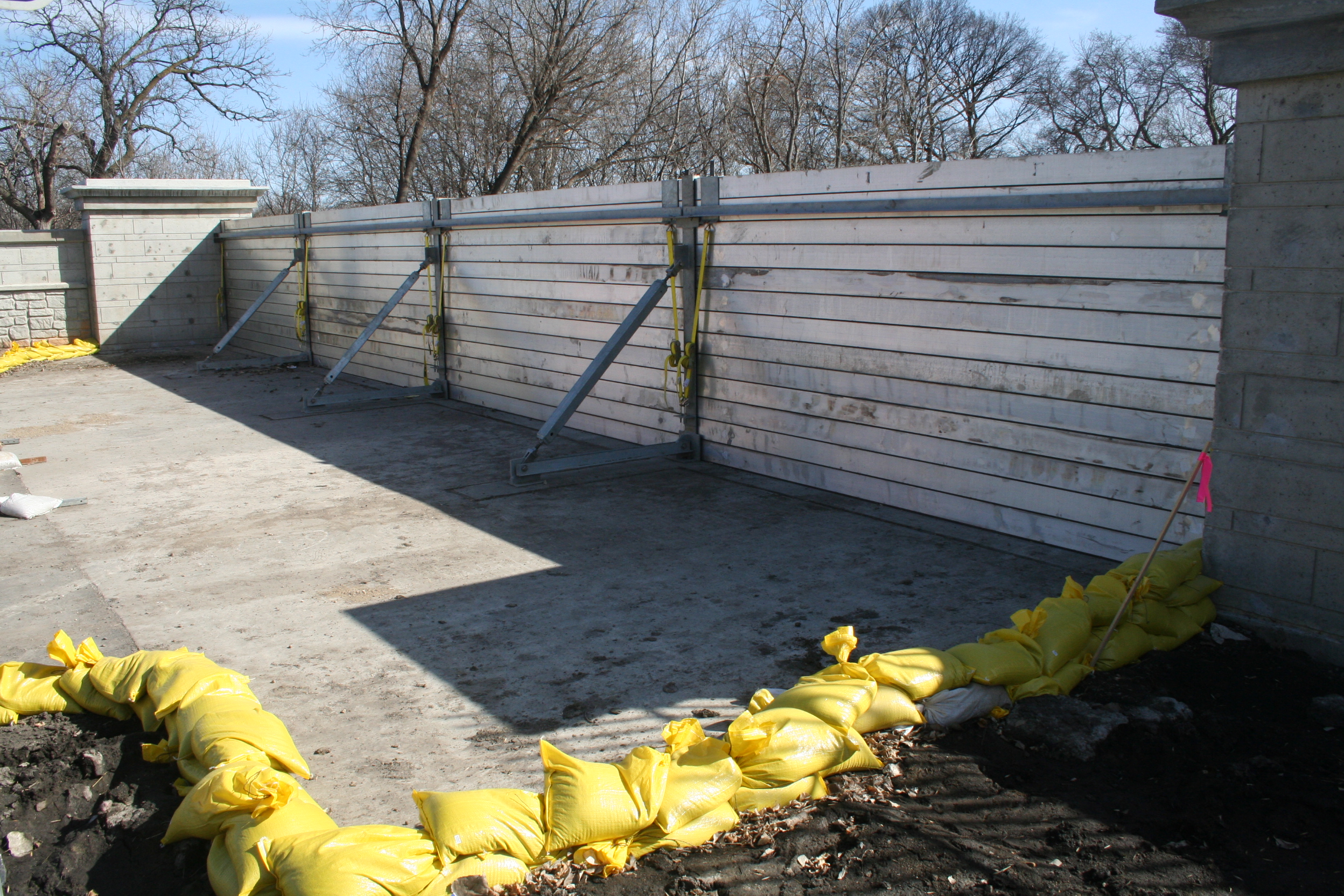
March 21: Elm Street at 15th Ave. N at flood crest. Flood barricades of the new flood wall (completed 2009) are working effectively. Red River stage (at Fargo): 36.99'.
© Donald Schwert
|

|
March 21: View of river crest facing toward the northwest from the parking garage, Moorhead Center Mall, Moorhead, Minnesota. Red River stage (at Fargo): 36.99'.
© Larry Hansen
|

|
March 21: View of river crest facing toward the southwest from the parking garage, Moorhead Center Mall, Moorhead, Minnesota. Red River stage (at Fargo): 36.99'.
© Larry Hansen
|

|
March 21: River recedes from its crest, Moorhead, Minnesota. Red River stage (at Fargo): 36.99'.
© Larry Hansen
|

|
March 21: Elm Street at 15th Ave. N at flood crest. Flood barricades of the new flood wall (completed 2009) are working effectively. Red River stage (at Fargo): 36.99'.
© Donald Schwert
|

|
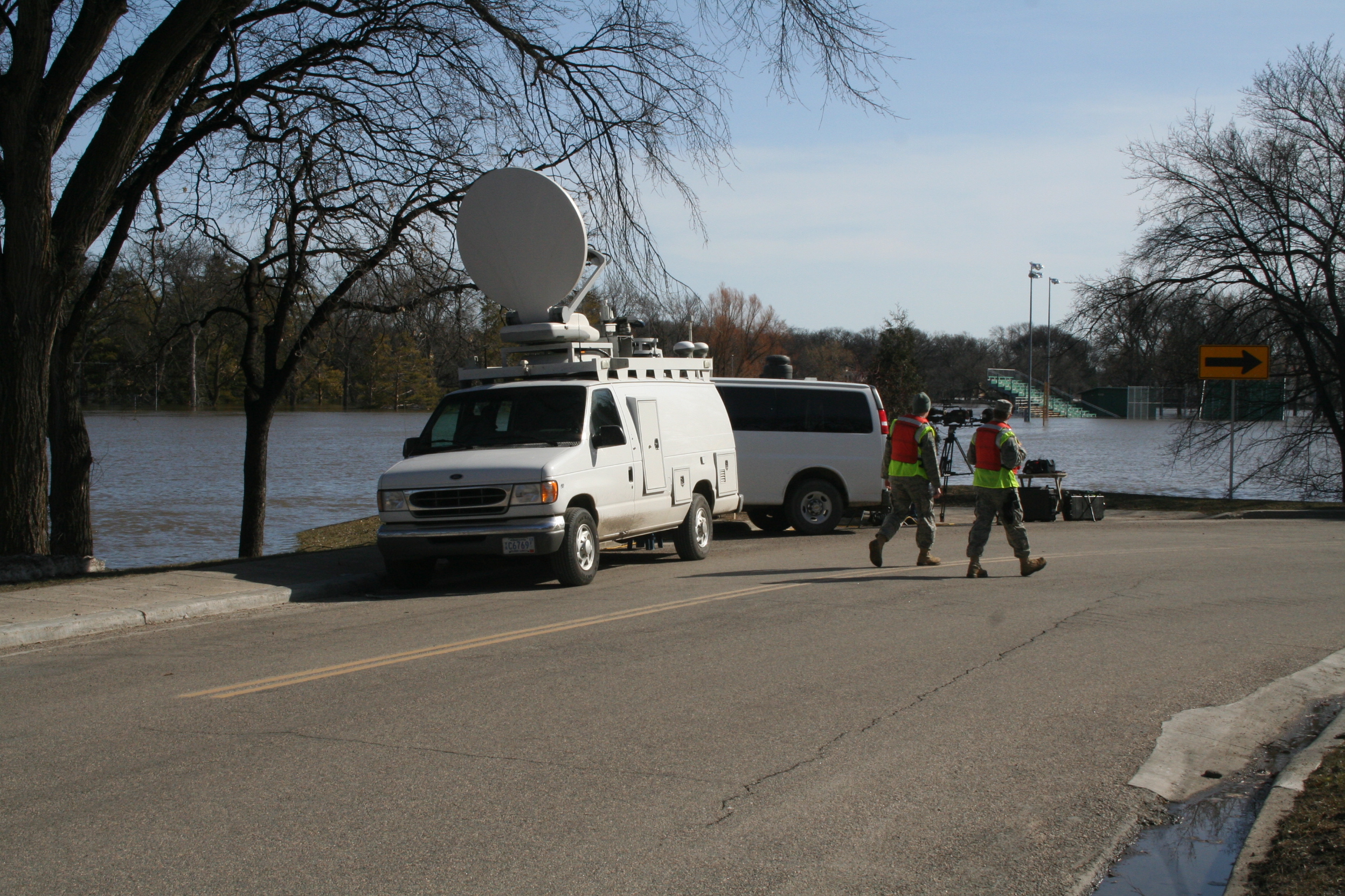
March 21: Elm Street at 11th Ave. N at flood crest. Satellite dishes beam news of the crest skyward, while National Guard soldiers guard the temporary dikes. Red River stage (at Fargo): 36.99'.
© Donald Schwert
|

|
March 21: Satellite dishes beam news of the crest skyward, from Moorhead, Minnesota. Red River stage (at Fargo): 36.99'.
© Larry Hansen
|

|
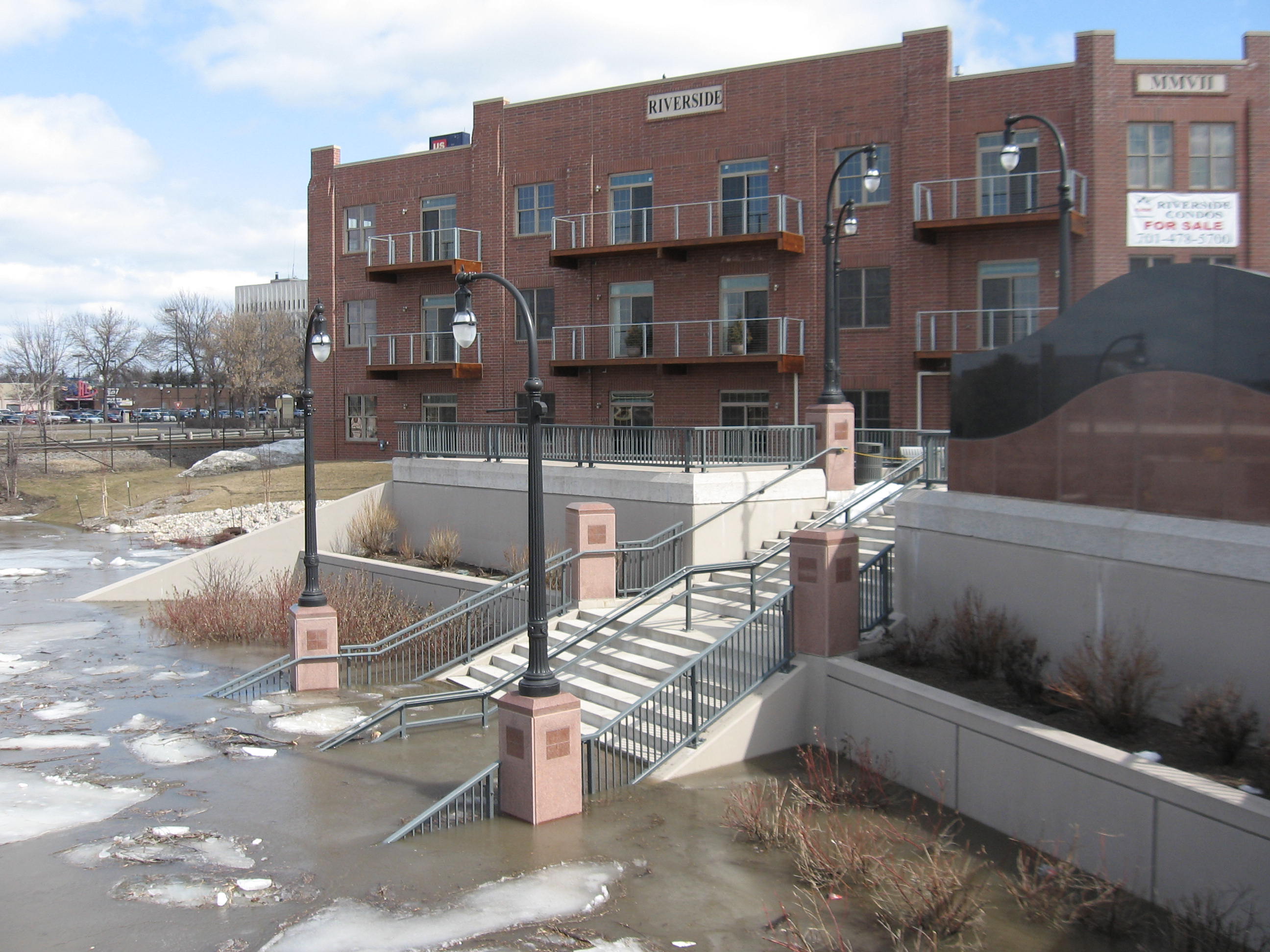
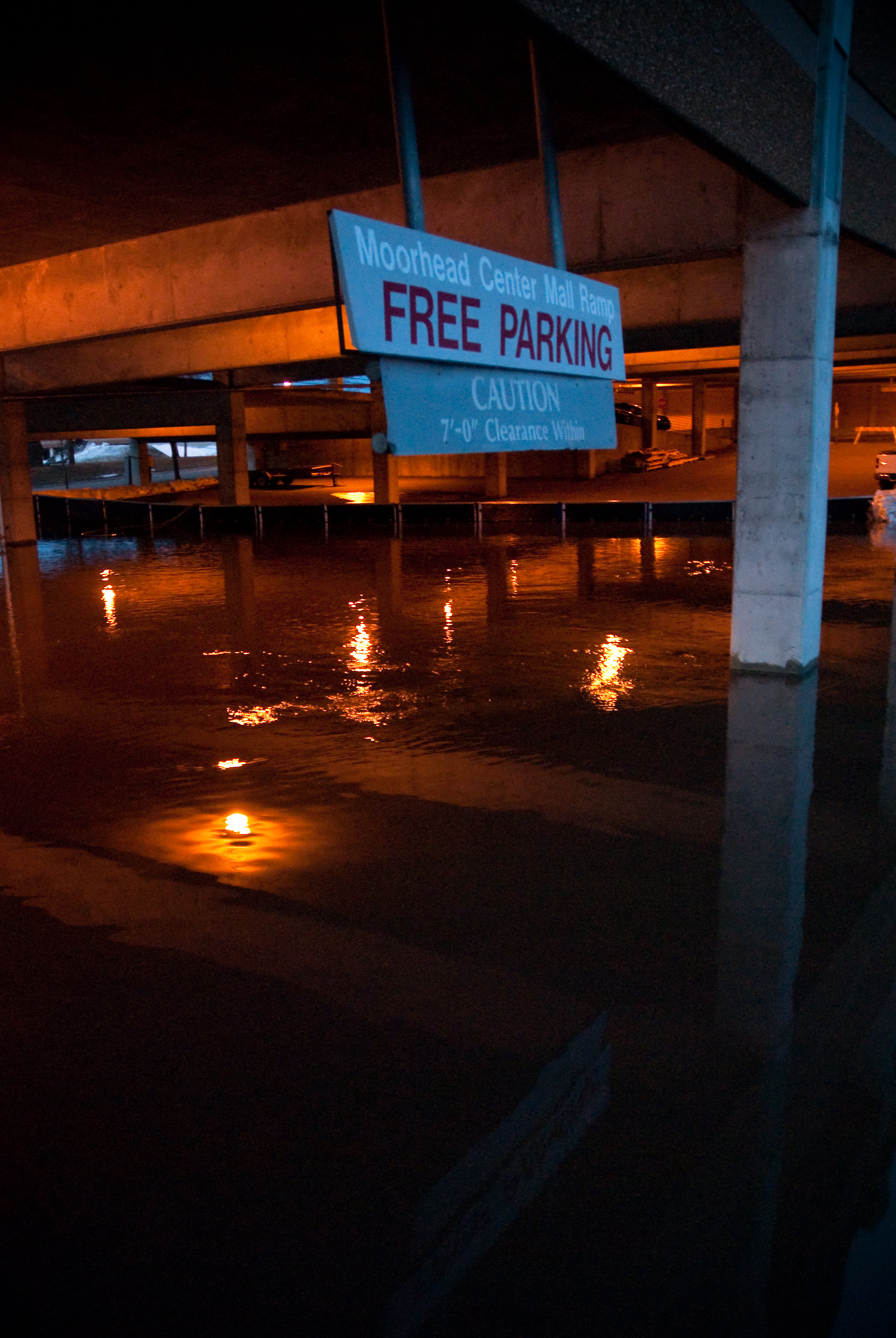
March 22: Parking remains "free" at the Moorhead Center Mall, Moorhead, Minnesota. Red River stage (at Fargo): 36.5'.
© Shane Reetz
|

|
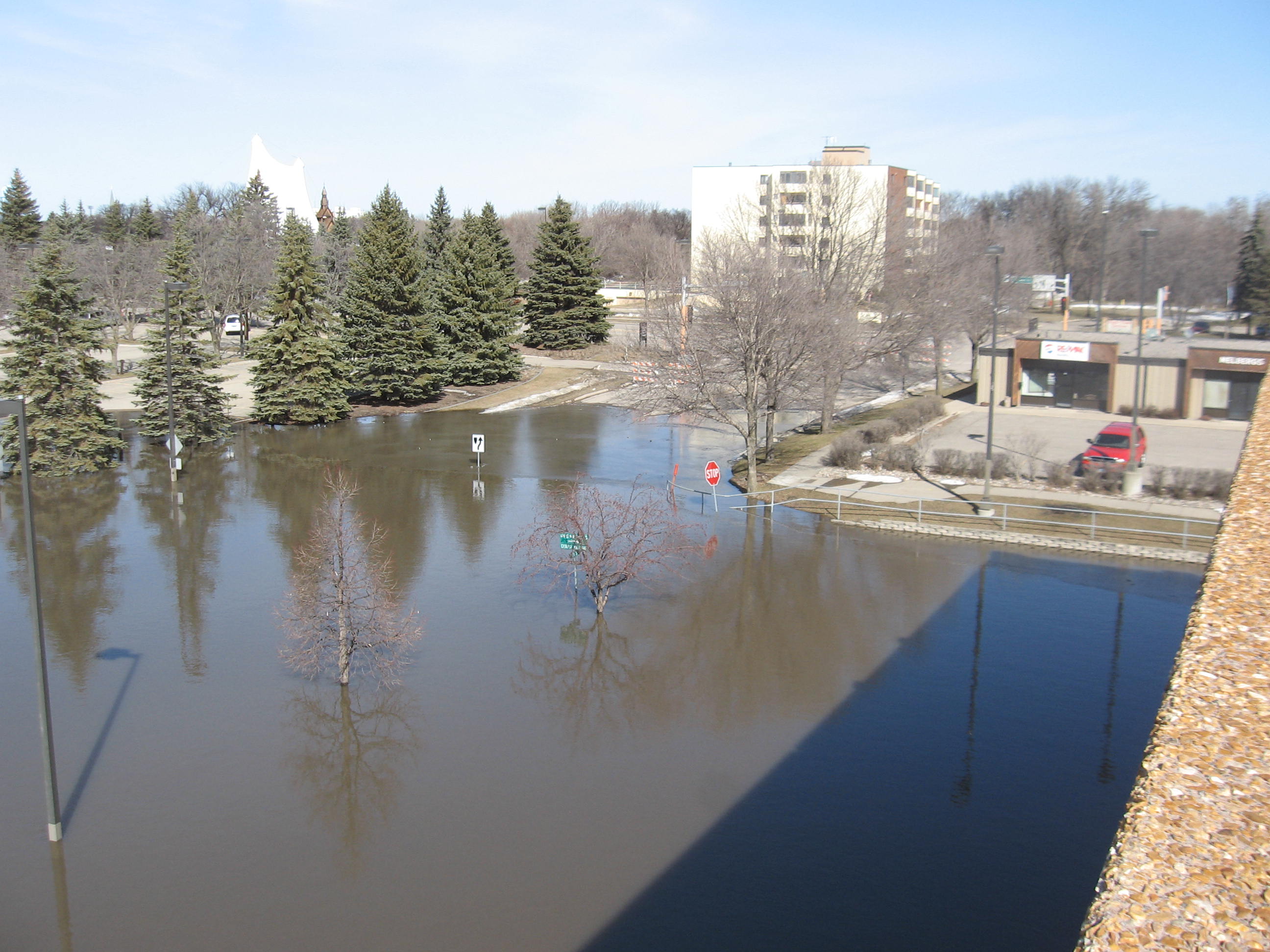
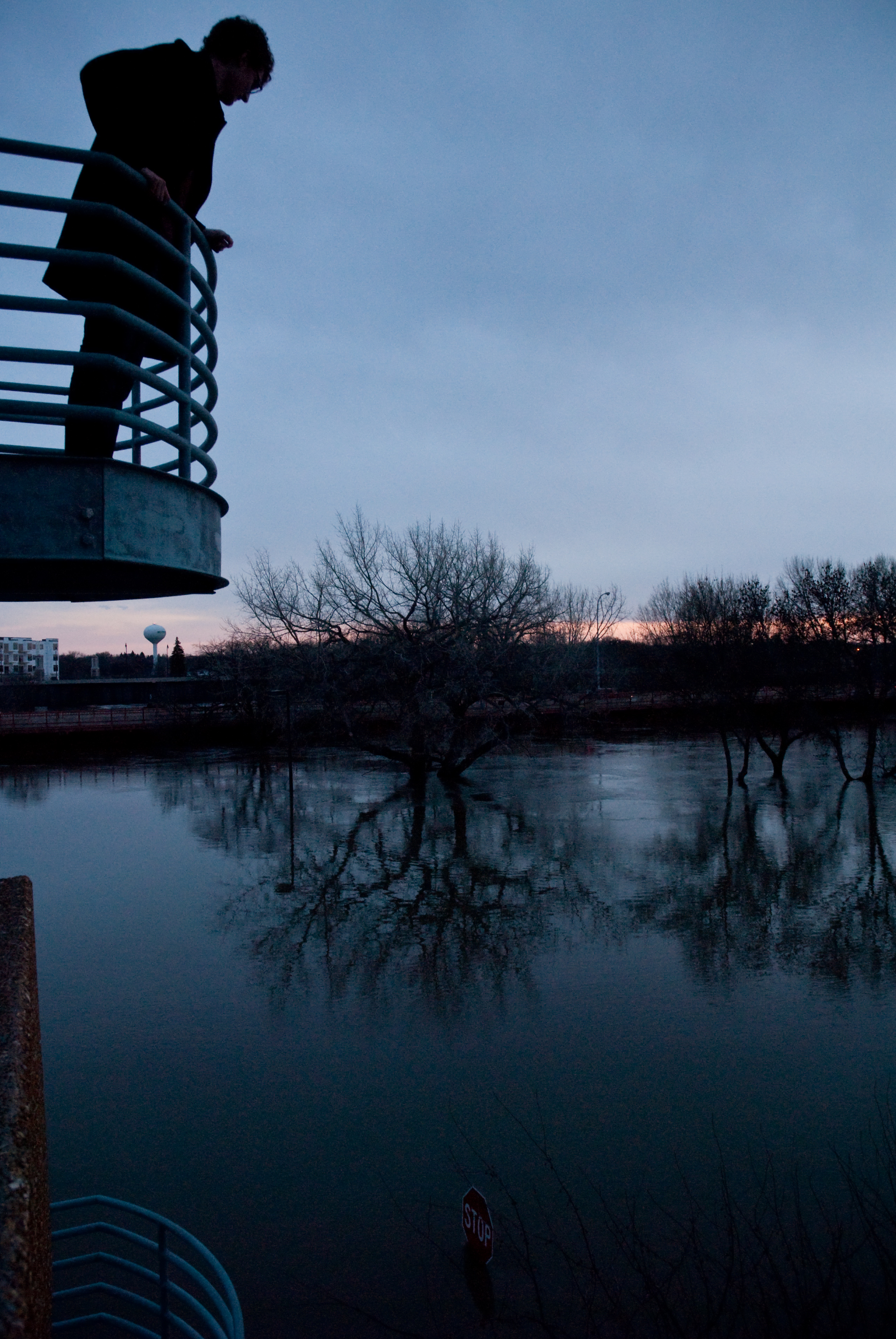
March 22: Flood view from the parking ramp, Moorhead Center Mall, Moorhead, Minnesota. Red River stage (at Fargo): 36.5'.
© Shane Reetz
|

|
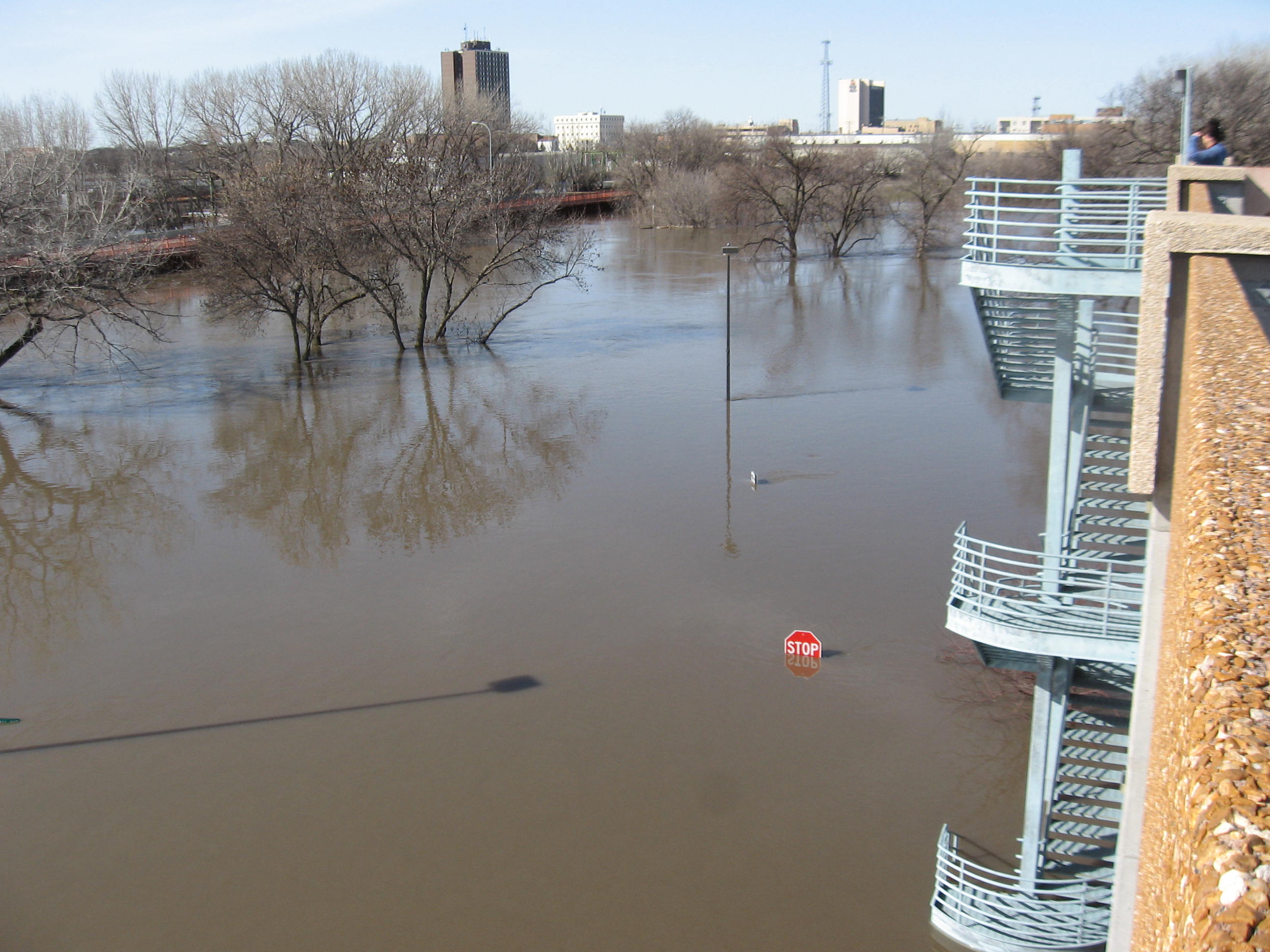
March 22: Stop sign, Moorhead, Minnesota. Red River stage (at Fargo): 36.5'.
© Shane Reetz
|

|
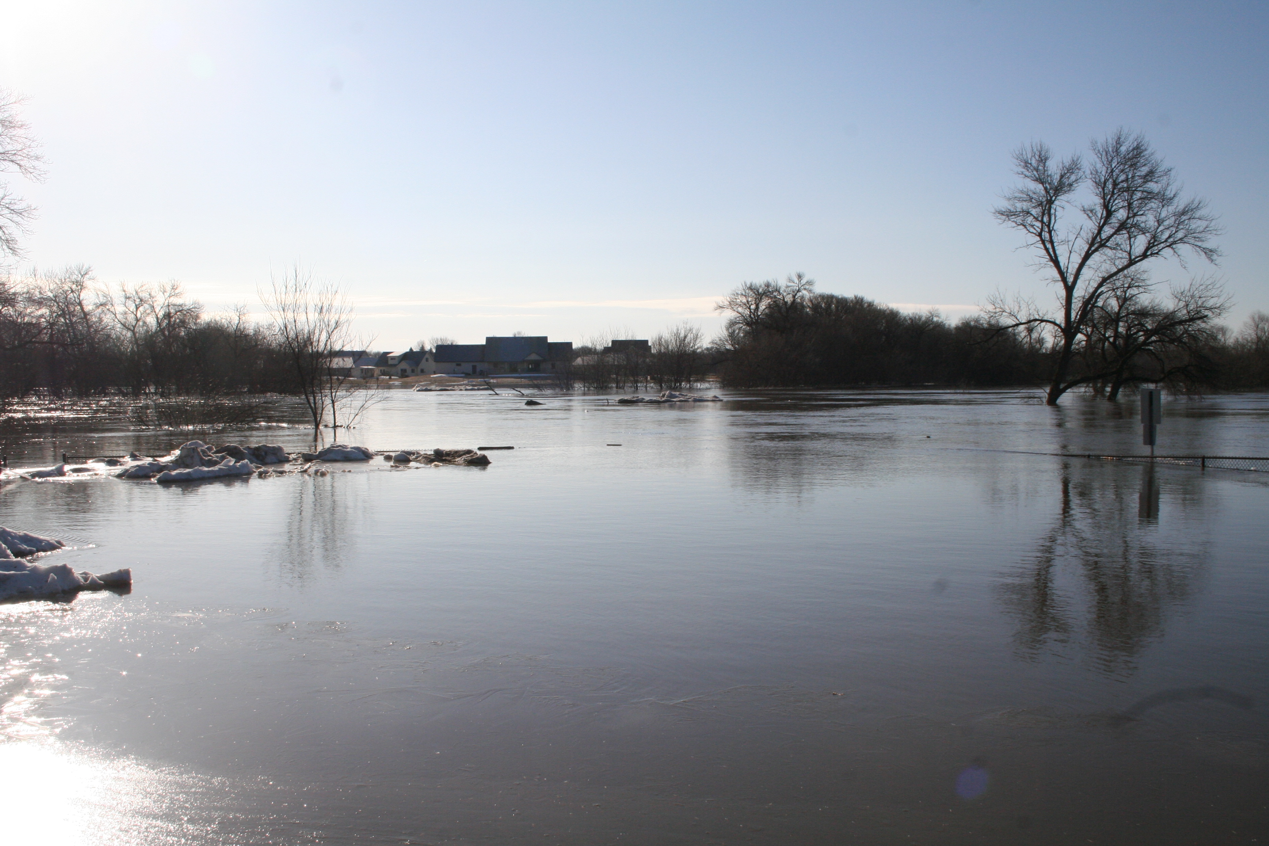
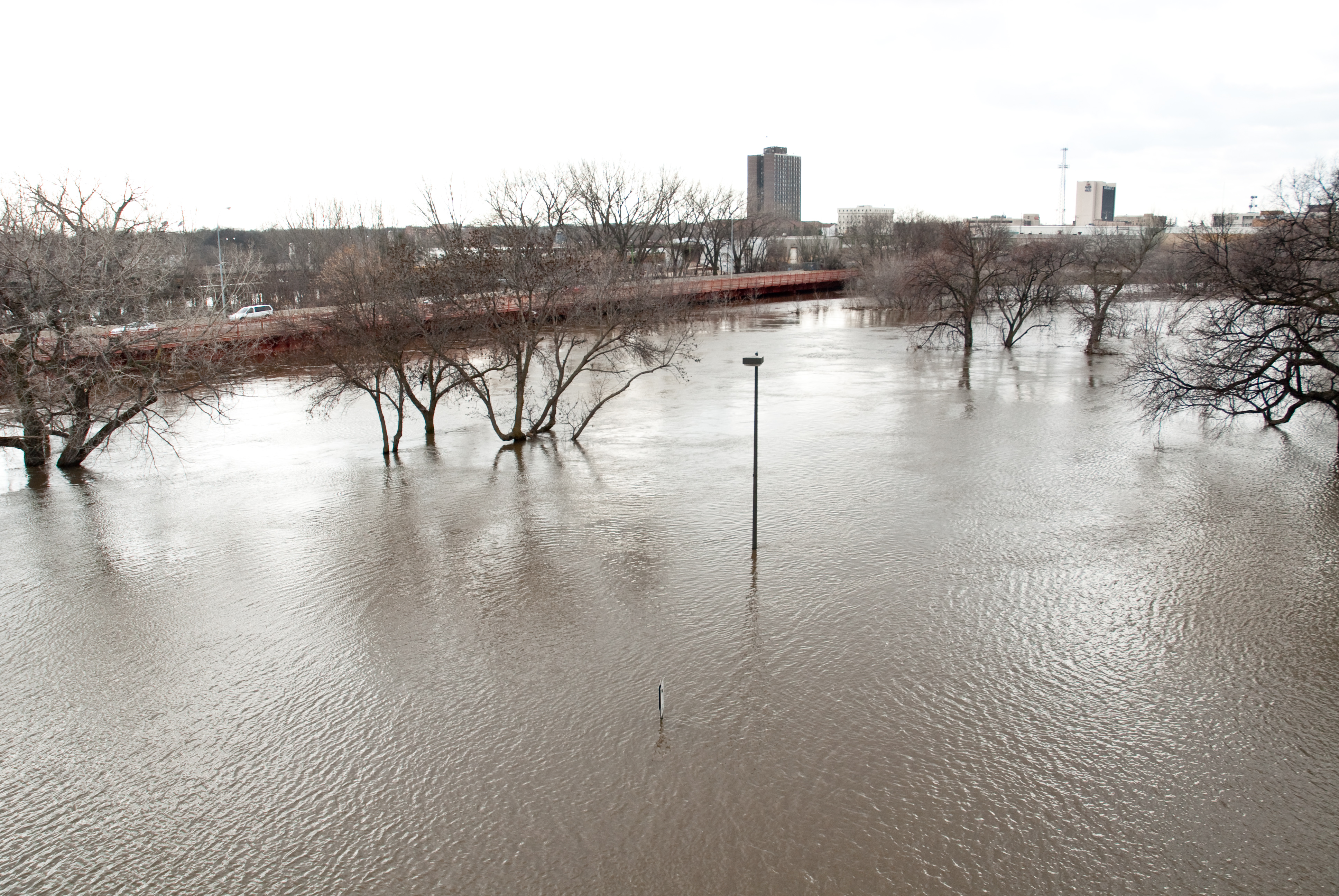
March 23: View of receding flood waters, facing southwest from Moorhead, Minnesota. Red River stage (at Fargo): 35.7'.
© Shane Reetz
|
 NORTH DAKOTA STATE UNIVERSITY
- FARGO, N D
NORTH DAKOTA STATE UNIVERSITY
- FARGO, N D