 Home Home
Image Map
Search
References
Links
|
|
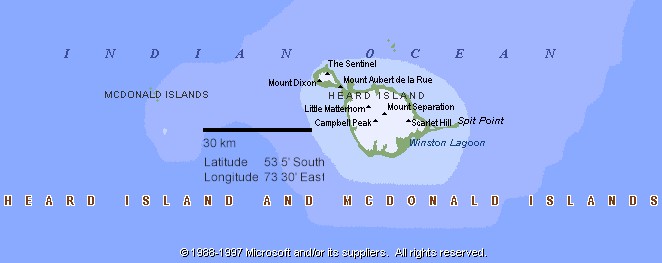
Heard Island:
52° 97' to 53° 20' S, 73° 25' to 73° 83'E
- Area: 390 km².
- Physical features:
One main volcanic island with offliers; Shag Island lies 1 km N
and McDonald Islands 38 km W in the Southern Ocean.
- Highest elevation -
2745 m Mawson Peak (active volcano).
- The island is volcanic
of basaltic composition. Over 90 % of its area is glaciated,
with ice up to 150 m deep.
- Cool maritime climate:
strong westerly winds prevail, mean annual temperature 1ºC,
with rainfall of 1400 mm/yr.
- There is little soil
development and there are no trees.
- Twenty species of bird
breed on Heard Island. Most bird species are reported as stable,
with those of King Penguin and Black-browed Albatross increasing.
- Over 50 species of
terrestrial arthropods are found, principally of the taxa Collembola,
Coleoptera, Diptera, and Lepidoptera.
- Historical Features:
Possibly sighted 1833 and 1848. Visited by American Captain
Heard in 1853. First landing in 1855 by sealers.
- Uninhabited (previously
sealers and scientific personnel wintered)
- Australian External
Territory.
McDonald Islands:
53° 03' S, 72° 36' E
- Area: 2.6 km².
- Physical Features:
The group comprises McDonald Island, with several small rocky islets
(Flat Island and Meyer Rock).
- Islands are composed
of basaltic lava and tuffaceous material, resulting from eruptions
of volcanic vents near sea level. There is little soil.
- Climate similar to
Heard island
- Historical features:
Discovered in 1854 by Captain McDonald of the British sealing vessel
Samarang. Some exploitation of seals and penguins occurred
in the 1800's.
- Uninhabited Australian
External Territory.
|