 Home Home
Image Map
Search
References
Links
|
|
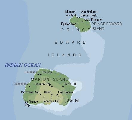
Prince Edward Islands: 46° 60' to 46° 97'S, 37°
58' to 38° 02'E
- Two islands (Marion Island 290 km˛ and Prince Edward Island 45
km˛
- 19 km apart, of volcanic origin, with offliers in the Indian
Ocean.
- Area: 335 (290 km˛ and 45 km˛ respectively).
- Highest elevation: 1230 m (State President Swart Peak, Marion
Island)
- One small ice-cap (1 % glaciated).
- Sighted 1663, first landing 1799 (by sealers)
- Permanent occupation (scientific station) from 1947 (previously
sealers wintered).
- South African territory, part of Eastern Cape Province.
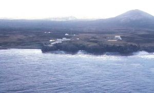
Marion Island
|