NORTH DAKOTA STATE UNIVERSITY
- FARGO, N D NORTH DAKOTA STATE UNIVERSITY
- FARGO, N D


Use Policy: For photographs attributed to the ND Institute for Regional Studies, contact the Institute directly for permissions. K-12 teachers are free to utilize all other photographs without permission for use in their personal classrooms, only. Please be sure to credit source(s).
For all uses not covered by the paragraph above, the owners of the photographs should be contacted, individually. Photographic scans were reduced in size to conserve server space. Larger, more detailed scanned versions for most of these photographs are available.

|
April, 1997, Flood: Red River of the North at the Georgetown, Minnesota, bridge. View is toward the southwest.
© Erik Hjelle
|

|
April, 1997, Flood: Air view onto cattle stranded by flooding on a gravel section road.
© Erik Hjelle
|

|
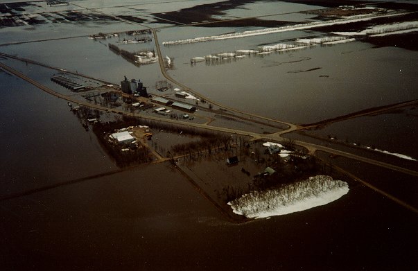
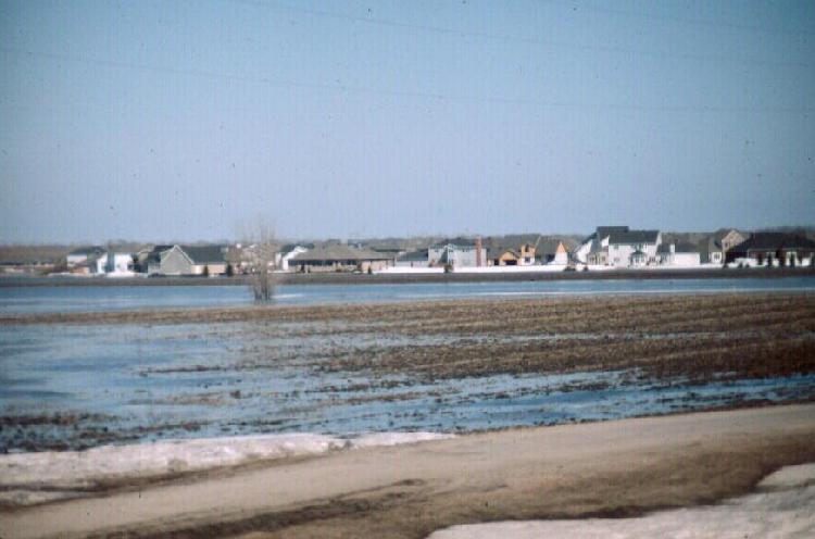
April, 1997, Flood: Air view onto Kragnes, Minnesota, north of Moorhead. View is toward the southwest.
© Erik Hjelle
|

|
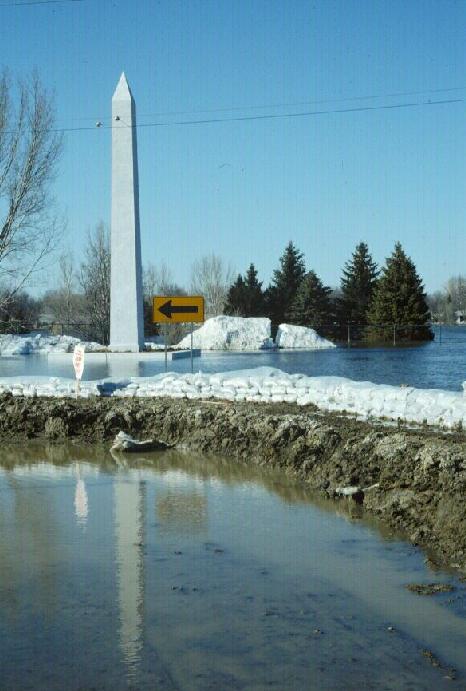
April, 1997, Flood: Is this the mall in Washington, D.C., or the obelisk at El Zagal Golf Course? April 16, 1997. River stage: 39.2'.
© Donald P. Schwert
|

|
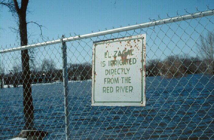
April, 1997, Flood: View of "water hazards" at Fargo's El Zagal Golf Course, April 16, 1997. River stage: 39.2'.
© Donald P. Schwert
|

|
April, 1997, Flood: Overland flooding approaching southern edge of Fargo. View is to the northeast from 52nd Ave. S. and I-29, April 16, 1997. River stage: 39.2'.
© Donald P. Schwert
|

|
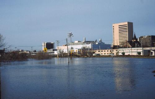
April, 1997, Flood: Downtown Fargo during Red River flood, April 17, 1997. Stage: 39.2'. View is toward the southwest.
© Donald P. Schwert
|

|
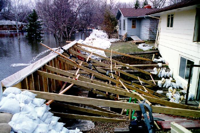
April, 1997, Flood: Woodland Drive in north Fargo. Reinforcing floodwall composed of plywood and 2x6 studs. April 19, 1997.
© Mark McCourt
|

|
April, 1997, Flood: Overland flooding near south edge of Fargo, April 20, 1997. View is to the northeast, with I-29 crossing the photo.
© Gary Goreham
|

|
April, 1997, Flood: Flood near Harwood, north of Fargo, April 20, 1997. View is to the southeast, with Harwood visible at upper right.
© Gary Goreham
|

|
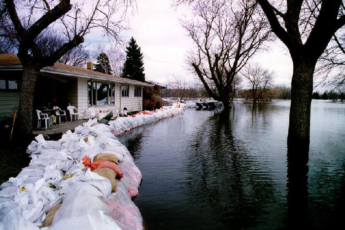
April, 1997, Flood: Woodland Drive in north Fargo. Completed floodwall and sandbag dikes. The neighborhood "held" under this effort.
© Mark McCourt
|

|
April, 1997, Flood: Woodland Drive in north Fargo. Sandbag dikes. The neighborhood "held" under this effort.
© Mark McCourt
|

|
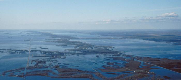
April, 1997, Flood: Air view near Argusville, north of Fargo, April 27, 1997. Red River stage (at Fargo): 35.3'. View is to toward the northeast. Confluence of Sheyenne and Red rivers is visible to the lower-right.
© Donald P. Schwert
|

|
April, 1997, Flood: Air view north of Fargo, April 27, 1997. Red River stage (at Fargo): 35.3'. View is to toward the northeast. Confluence of Sheyenne and Red rivers is visible at the upper-right.
© Donald P. Schwert
|

|
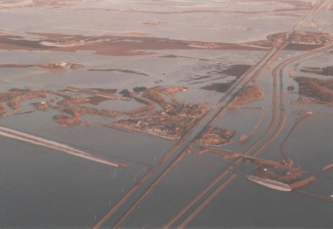
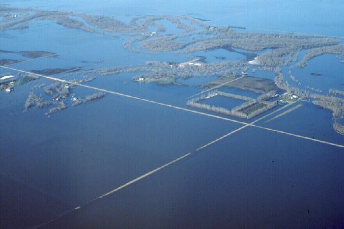
April, 1997, Flood: Air view of Harwood, north of Fargo, April 27, 1997. Village was protected by a hastily-constructed dike. Red River stage (at Fargo): 35.3'. View is to toward the southwest.
© Donald P. Schwert
|

|
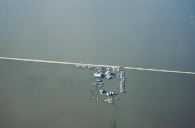
April, 1997, Flood: Air view northwest of Fargo, April 27, 1997. Red River stage (at Fargo): 35.3'. View onto flooded farm.
© Donald P. Schwert
|

|
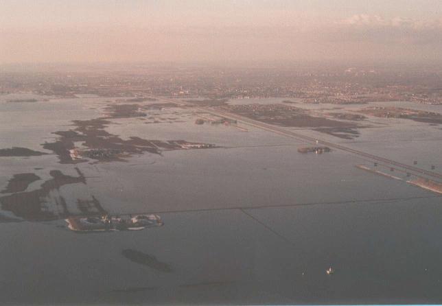
April, 1997, Flood: Air view of the diversion channel wrapping around the west and north sides of West Fargo, April 27, 1997. West Fargo was saved from major flooding by this structure. Red River stage (at Fargo): 35.3'. View is toward the northeast.
© Donald P. Schwert
|

|
April, 1997, Flood: Air view along Red River south of Fargo, April 27, 1997. Red River stage (at Fargo): 35.3'.
© Donald P. Schwert
|

|
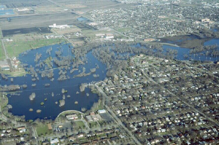
April, 1997, Flood: Air view along Red River in north Fargo. View is toward the west. El Zagal Golf Course is at lower-left. Red River stage (at Fargo): 35.3'.
© Donald P. Schwert
|
[ Return to NDSU's Red River Flood Homepage ]
[ Geology of Fargo Homepage ]
|