NORTH DAKOTA STATE UNIVERSITY
- FARGO, N D NORTH DAKOTA STATE UNIVERSITY
- FARGO, N D


Use Policy: For photographs attributed to the ND Institute for Regional Studies, contact the Institute directly for permissions. K-12 teachers are free to utilize all other photographs without permission for use in their personal classrooms, only. Please be sure to credit source(s).
For all uses not covered by the paragraph above, the owners of the photographs should be contacted, individually. Photographic scans were reduced in size to conserve server space. Larger, more detailed scanned versions for most of these photographs are available.

|
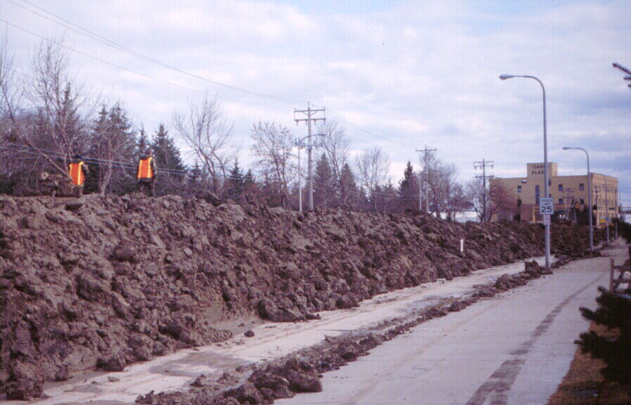
April, 2001, Flood: Constructing temporary dike along Oak Street in north Fargo. View is eastward toward Mickelson Field. April 10, 2001. Red River stage (at Fargo): 31.5'.
© Marty Hoag
|

|
April, 2001, Flood: Constructing temporary dike along Oak Street in north Fargo. View is eastward toward Mickelson Field. April 10, 2001. Red River stage (at Fargo): 31.5'.
© Marty Hoag
|

|
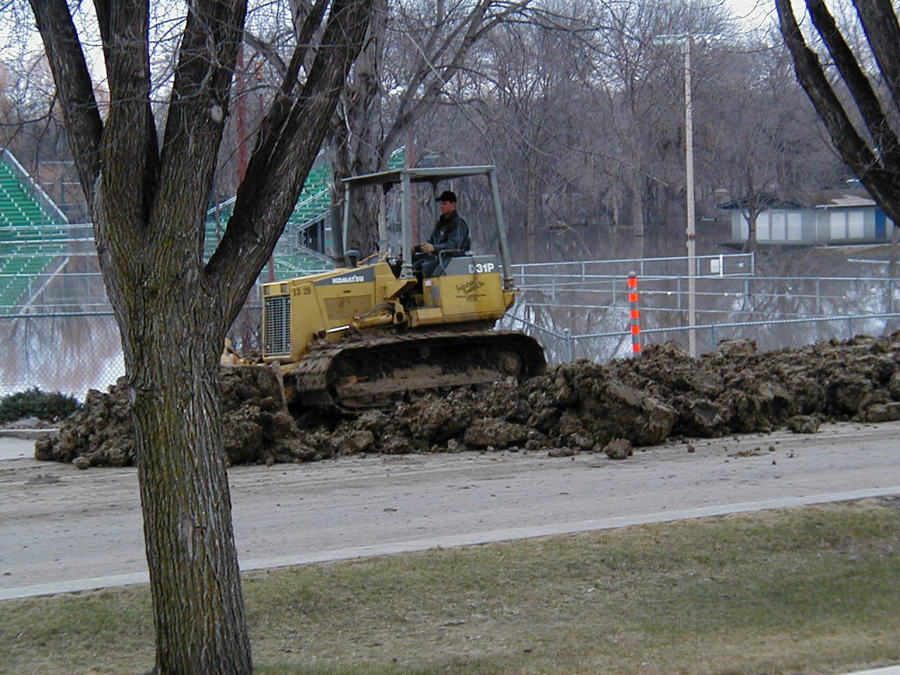
April, 2001, Flood: Cutting through Clay County Highway 93 to relieve flooding pressure, Oakport Township, Minnesota (just north of Fargo). April 12, 2001. Red River stage (at Fargo): 35.1'.
© Steven Adamek
|

|
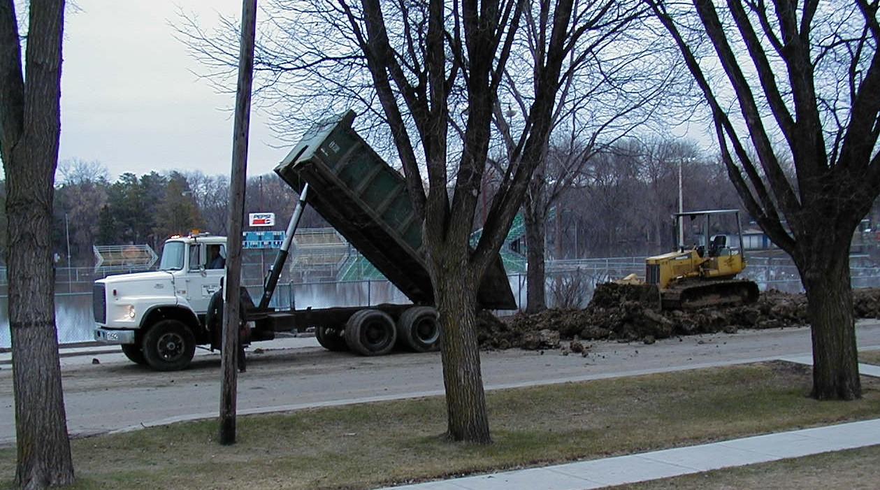
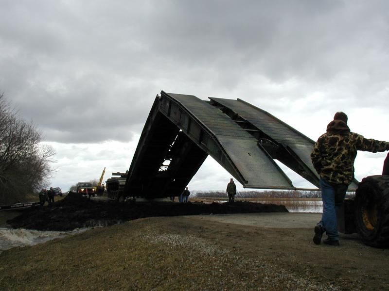
April, 2001, Flood: Placing temporary bridge across cut in Clay County Highway 93 made to relieve flooding pressure, Oakport Township, Minnesota (just north of Fargo). April 12, 2001. Red River stage (at Fargo): 35.1'.
© Steven Adamek
|

|
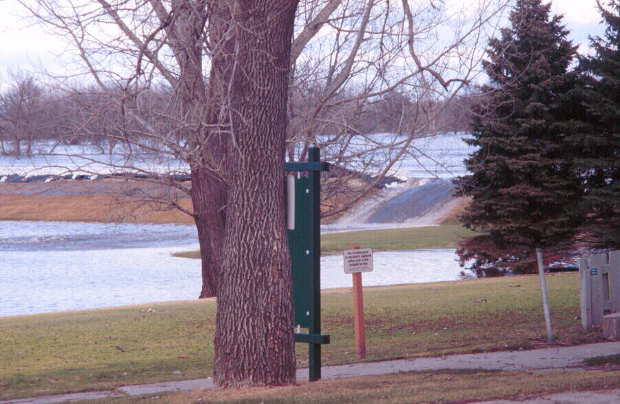
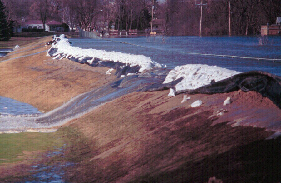
April, 2001, Flood: Failure of sandbagged portion of dike at El Zagal Golf Course, north Fargo. April 12, 2001. Red River stage (at Fargo): 35.1'.
© Donald P. Schwert
|

|
April, 2001, Flood: Failure of sandbagged portion of dike at El Zagal Golf Course, north Fargo. April 12, 2001. Red River stage (at Fargo): 35.1'.
© Donald P. Schwert
|

|
April, 2001, Flood: Temporary earthen dike along 2nd Street North in downtown Fargo. April 13, 2001.
© Donald P. Schwert
|

|
April, 2001, Flood: View of downtown Fargo during flood crest. April 14, 2001. Red River stage (at Fargo): 36.7'.
© Donald P. Schwert
|

|
April, 2001, Flood: View of downtown Fargo during flood crest. April 14, 2001. Red River stage (at Fargo): 36.7'.
© Donald P. Schwert
|

|
April, 2001, Flood: View of downtown Fargo during flood crest. April 14, 2001. Red River stage (at Fargo): 36.7'.
© Donald P. Schwert
|

|
April, 2001, Flood: Airview of Interstate 94 bridge during flood crest. View is to the southwest. April 14, 2001. Red River stage (at Fargo): 36.7'.
© Donald P. Schwert
|

|
April, 2001, Flood: Airview of 52nd Avenue South during flood crest. View is to the southwest. April 14, 2001. Red River stage (at Fargo): 36.7'.
© Donald P. Schwert
|

|
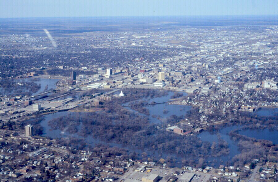
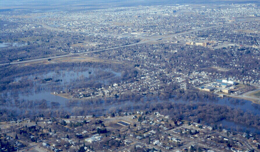
April, 2001, Flood: Airview south of Fargo, April 14, 2001. Red River stage (at Fargo): 36.7'.
© Donald P. Schwert
|

|
April, 2001, Flood: Airview south of Fargo, April 14, 2001. Red River stage (at Fargo): 36.7'.
© Donald P. Schwert
|

|
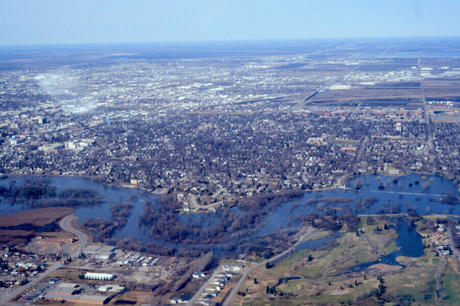
April, 2001, Flood: Airview south of Fargo, April 14, 2001. Red River stage (at Fargo): 36.7'.
© Donald P. Schwert
|

|
April, 2001, Flood: Airview south of Fargo, April 14, 2001. Hwy 81 is in foreground. Facing southwest. Red River stage (at Fargo): 36.7'.
© Donald P. Schwert
|

|
April, 2001, Flood: Airview south of Fargo, April 14, 2001. Facing north toward Fargo. Hwy 81 (right) and Interstate 29 (left) visible. Red River stage (at Fargo): 36.7'.
© Donald P. Schwert
|

|
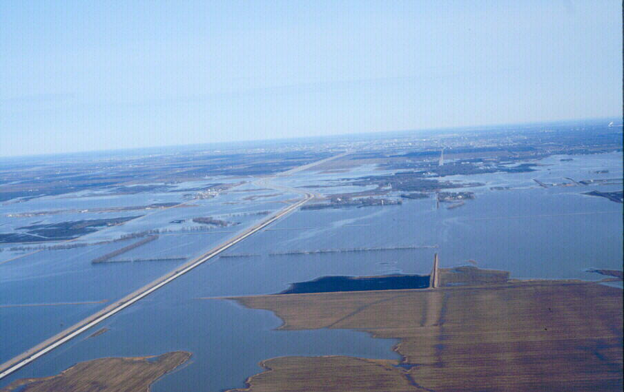
April, 2001, Flood: View facing north along I-29 toward Fargo during flood crest. April 14, 2001. Red River stage (at Fargo): 36.7'.
© Donald P. Schwert
|

|
April, 2001, Flood: Residential development along Red River south of Fargo during flood crest. April 14, 2001. Red River stage (at Fargo): 36.7'.
© Donald P. Schwert
|

|
April, 2001, Flood: View facing west across south Fargo. Fargo Water Treatment plant visible at lower-left. Photo is during flood crest. April 14, 2001. Red River stage (at Fargo): 36.7'.
© Donald P. Schwert
|

|
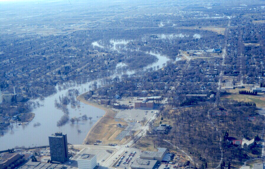
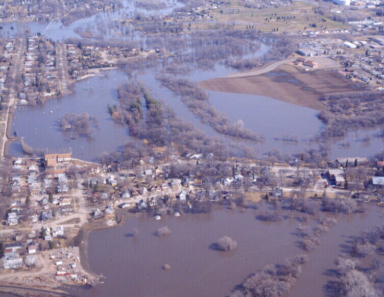
April, 2001, Flood: View onto Oak Grove neighborhood of north Fargo during flood crest. April 14, 2001. Red River stage (at Fargo): 36.7'.
© Donald P. Schwert
|

|
April, 2001, Flood: View facing north along Red River. Oak Grove School in foreground. Photo is during flood crest. April 14, 2001. Red River stage (at Fargo): 36.7'.
© Donald P. Schwert
|

|
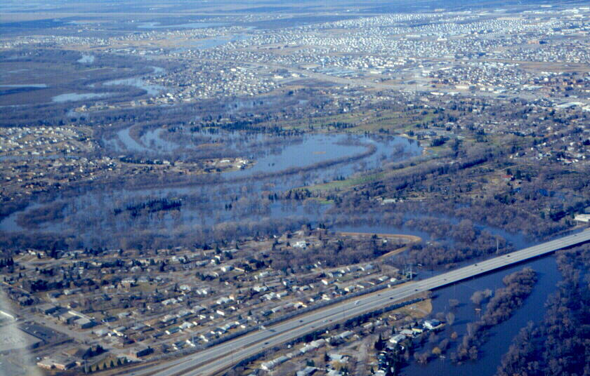
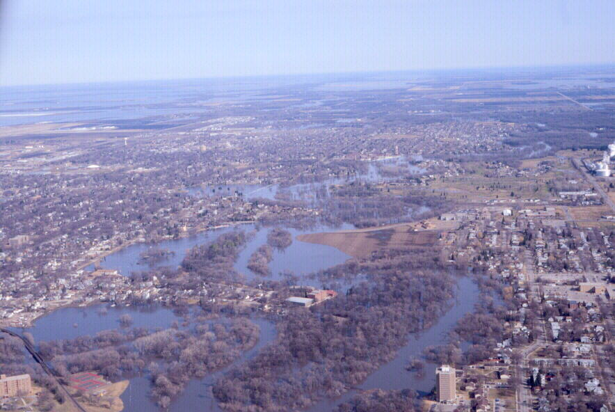
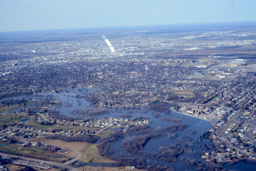
April, 2001, Flood: View facing west across north Fargo. Flooded El Zagal Golf Course is at right edge. Photo is during flood crest. April 14, 2001. Red River stage (at Fargo): 36.7'.
© Donald P. Schwert
|

|
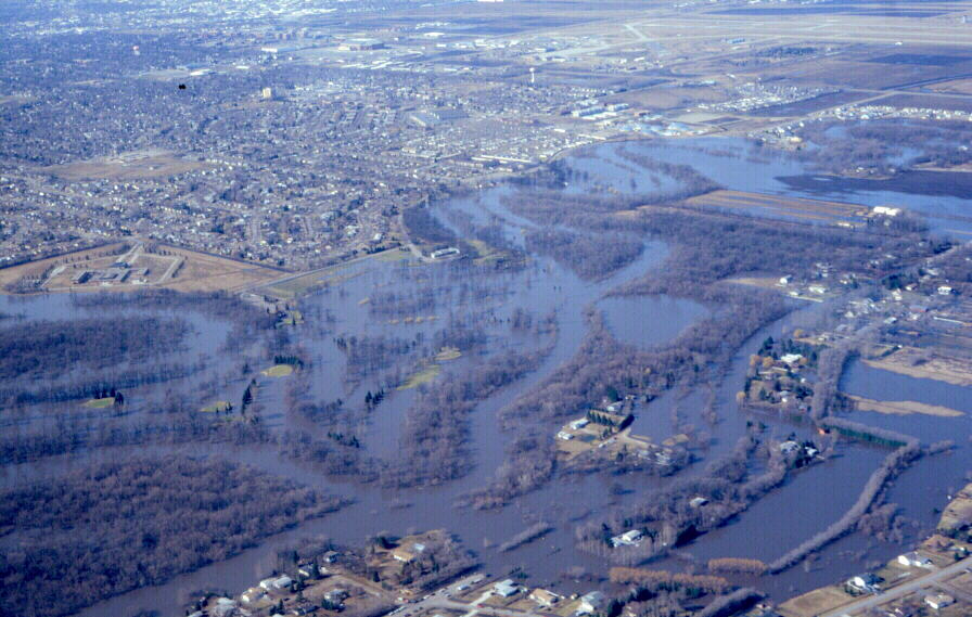
April, 2001, Flood: View of north Fargo facing southwest along Red River. Flooded El Zagal Golf Course in left-center. Photo is during flood crest. April 14, 2001. Red River stage (at Fargo): 36.7'.
© Donald P. Schwert
|

|
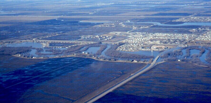
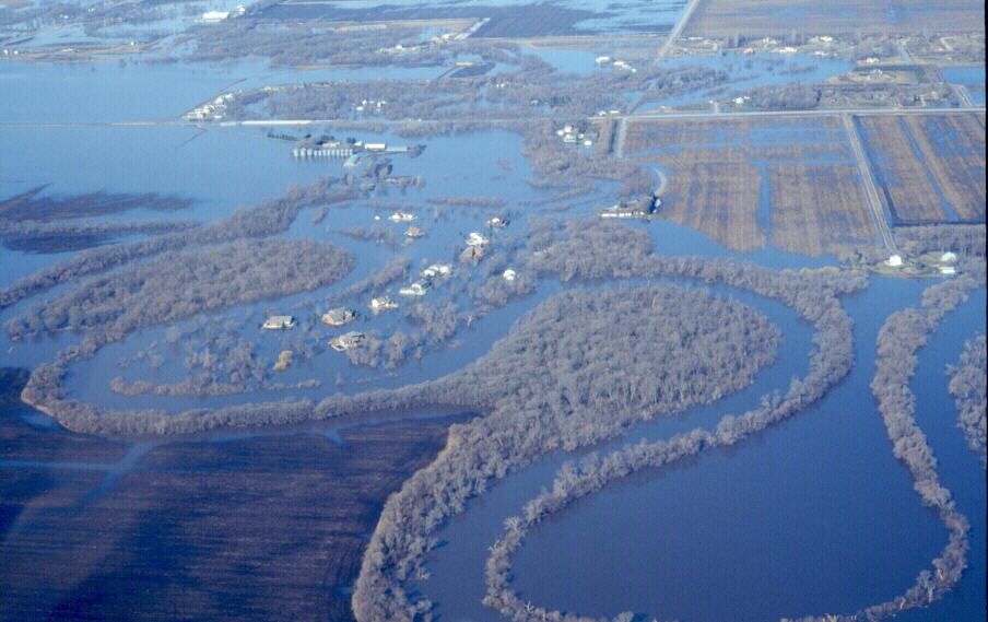
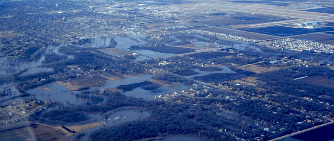
April, 2001, Flood: Oakport Township during flood crest. View is facing southwest toward north Fargo. Cardinal Muench Seminary visible at left-center. April 14, 2001. Red River stage (at Fargo): 36.7'.
© Donald P. Schwert
|

|
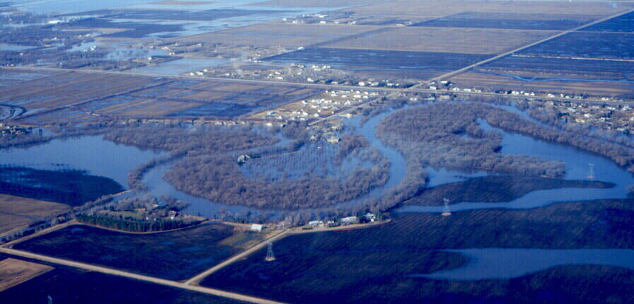
April, 2001, Flood: Oakport Township during flood crest. View is facing southwest toward north Fargo. April 14, 2001. Red River stage (at Fargo): 36.7'.
© Donald P. Schwert
|

|
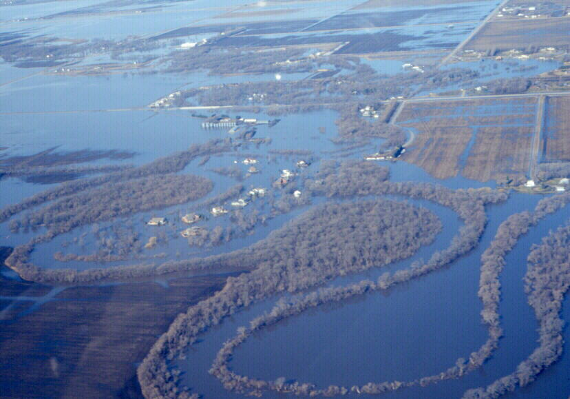
April, 2001, Flood: Confluence of Red and Sheyenne Rivers near Argusville, north of Fargo. April 14, 2001. Red River stage (at Fargo): 36.7'.
© Donald P. Schwert
|

|
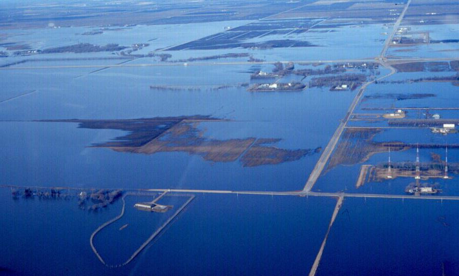
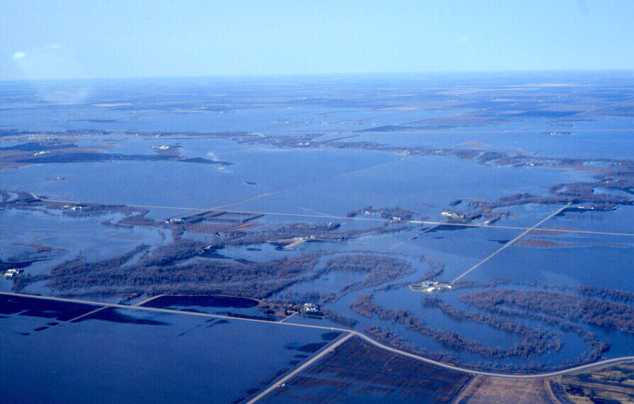
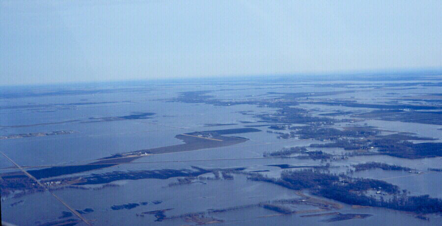
April, 2001, Flood: Overland flooding north of Fargo. Photo is during flood crest. April 14, 2001. Red River stage (at Fargo): 36.7'.
© Donald P. Schwert
|

|
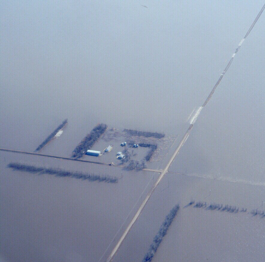
April, 2001, Flood: Flooded farmstead northwest of Fargo. Photo is during flood crest. April 14, 2001. Red River stage (at Fargo): 36.7'.
© Donald P. Schwert
|
[ Return to NDSU's Red River Flood Homepage ]
[ Geology of Fargo Homepage ]
|