|
North and northwest of the Fargo Sewage Treatment Plant, the Red River meanders generally westward and then turns abruptly northward. Intensive residential development of this region occurred during the 1990's. Several properties bordering the river here have since experienced severe problems with slope instability. Other properties today remain highly vulnerable.
This particular case study will center on residential properties at the east end of a cul-de-sac on the 3700 block of N. 10th Street, constructed in the mid-1990's.

|
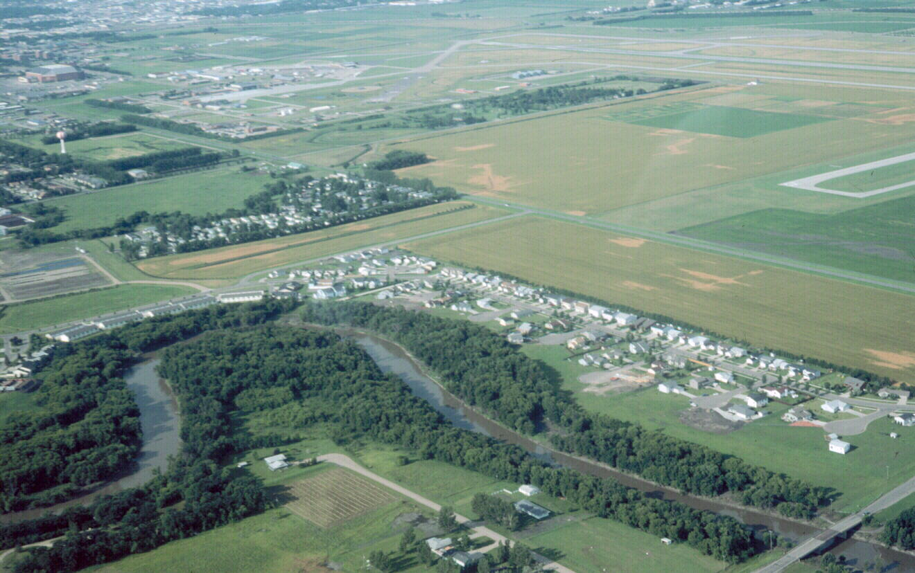
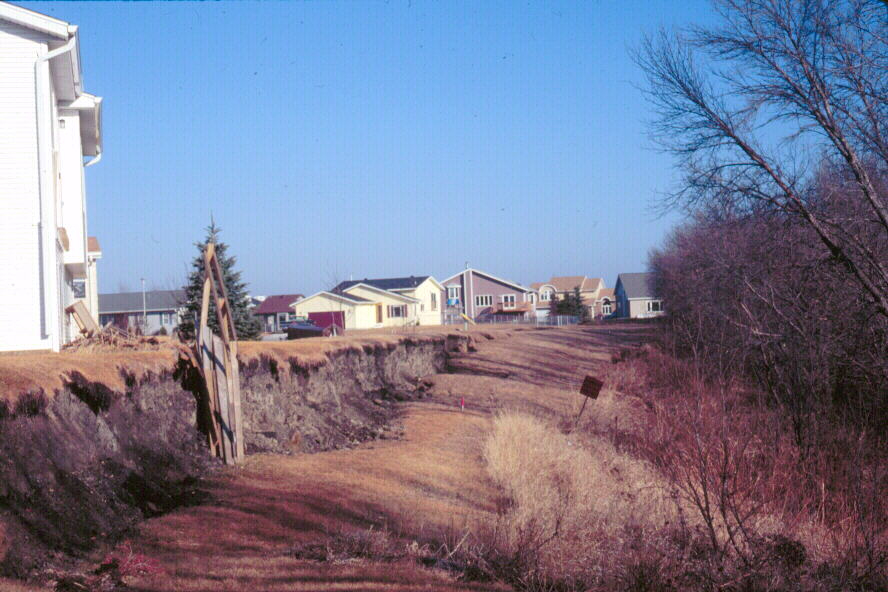
| Region of N 10th Street in July, 2000. View is to the southwest. Arrow points to cul-de-sac on 3700 block of N. 10th Street, from which several houses had been removed in June, 2000, due to mass wasting. Note position of many of the remaining residential properties on the outside of a tight meander on the Red River. River flow is toward the right of the photo.
(Click on photo for enlargement)
|
The geologic vulnerability of some of the houses at the east end of the cul-de-sac was evident, even as the houses were being constructed. Our photographic archive therefore begins with the completion of one of these houses in Spring, 1995.

|
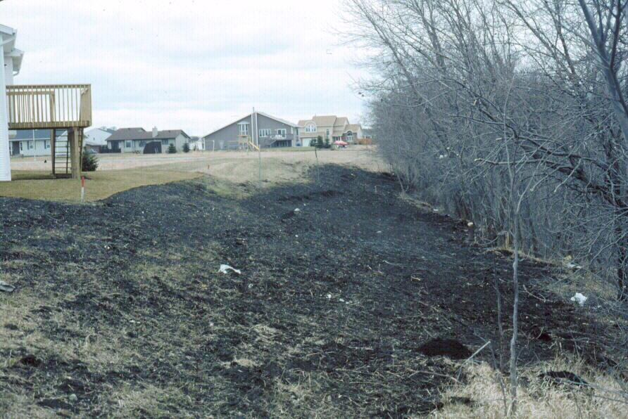
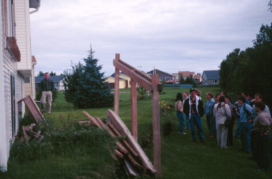
| View northward from east end of 3700 block of cul-de-sac, April 14, 1995. Red River is to the right (east) of the photo. Note the white house with balcony, whose construction is nearing completion. The balcony and the house rest partially on a low dike. All of the following photos will use this house/balcony for reference.
(Click on photo for enlargement)
|
As in Case Study #1, the problems here were associated with:
- Siting of house construction on the outside of a river meander
- Slope retreat associated with bank erosion
- Overloading of a slope by emplacement of housing
In addition, the white house was partially constructed on a low dike, which in turn was adding to the load on this vulnerable slope.
The following photos document the history of slope failure. The balcony of the white house (photo, above) provides a reference point.
RELOCATION OF HOUSES FROM EAST END OF CUL-DE-SAC,
3700 BLOCK OF N. 10TH STREET
|
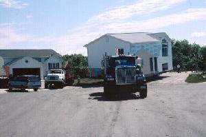 |
Removal of houses from east
end of cul-de-sac
on 3700 block, June, 2000.
(Click on photo for enlargement)
|
|
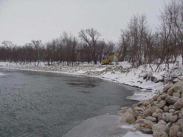
In February, 2001, in an attempt to stabilize the cutbank, the U.S. Army Corps of Engineers installed riprap along the meander loop here. Taxpayers on both a local and national level were left to pay for the consequences of poor planning/building decisions. The geologic lessons are simple: whether it be to avoid flooding or the dangers of slope instability, development adjacent to slopes of any type in the Red River Valley represents unwise land use.
|

|
Installation of riprap on outside of meander loop, just east of the 3700 block of N. 10th Street in Fargo, February 11, 2001.
(Click on photo for enlargement)
|
| Movie of installation of riprap on outside of meander loop, just east of the 3700 block of N. 10th Street in Fargo, February 11, 2001.
(Mpeg view required. Click on photo to begin movie.)
|

|

[ Return to "Slope Instability and Mass Wasting in Fargo, ND" ]
[ Return to "Geology of Fargo-Moorhead Region" ]
This web site represents the views of the authors and not necessarily those of North Dakota State University. NDSU is not responsible or liable for its contents. Copyright © Department of Geosciences, North Dakota State University.
|
 NORTH DAKOTA STATE UNIVERSITY
- FARGO, N D
NORTH DAKOTA STATE UNIVERSITY
- FARGO, N D