NORTH DAKOTA STATE UNIVERSITY
- FARGO, N D NORTH DAKOTA STATE UNIVERSITY
- FARGO, N D


During recent years in Fargo, the Red River has passed into flood stage at least once per year. During most years, this flooding has been minor. However, since the beginning of a wet climatic cycle in 1993, several of these floods have been truly devastating.

|
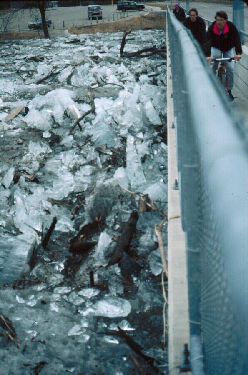
| Ice jam against 12th Avenue toll bridge, March 19, 1995. Because of the susceptibility of the Red River to ice jam development, low-level bridges such as this are a particularly poor choice of design.
(Click on image for enlargement).
|
Why does the Red River flood so frequently and with such extensive areal coverage throughout the "Valley"? Four factors, all associated with our unusual physiography, seem to be involved:
1. SYNCHRONY OF DISCHARGE WITH SPRING THAW:
The Red River flows northward. But, at the same time, spring thaw proceeds steadily northward along the Valley. Thus, along the Red River, runoff from the southern portion of the Valley progressively joins with fresh, meltoff waters from more northerly localities. If this synchrony is perfect, the consequences in the northern portion of the Valley can be truly disastrous.
2. ICE JAMS:
This factor is also related to a northward-flowing river system. Ice derived from the southern Valley progressively meets with freshly-broken ice in the central and northern Valley. Ice concentrations in this regime can only build, retarding or damming water flow.
3. GLACIAL LAKE PLAIN:
The Red River has incised a shallow, sinuous valley across one of the
flattest expanses of land in the world: the floor of Glacial Lake Agassiz. Therefore, when the river floods onto this plain, areal coverage of the waters can become dramatic.

|
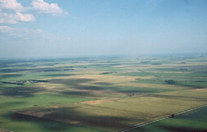
| The youthfulness, flatness, and slope direction of the Red River Valley all contribute to its susceptibility to flooding.
(Click on image for enlargement).
|
Related to this physiographic factor is the young age of the Red River. In its present form, the Red River is about 9,300 years old and far too young geologically to have carved a significant valley-floodplain system. Therefore, the lake plain becomes the "floodplain" to this river.
4. DECREASE IN GRADIENT DOWNSTREAM:
"Gradient" refers to the slope of a river. In the region of Fargo-Halstad, the gradient of the Red River averages 5 inches per mile of length. In the region of Drayton-Pembina, however, the gradient drops to 1.5 inches per mile. During floods, the Red River at Drayton tends to pool due to lack of slope - the region becoming essentially a massive, shallow lake.
[ Return to NDSU's Red River Flood Homepage ]
[ "Geology of Fargo" Homepage ]
This web site represents the views of the author and not necessarily those of North Dakota State University. NDSU is not responsible or liable for its contents. Copyright © 2009, Donald P. Schwert.
|