
Successful Reclamation of Lands Disturbed by Energy Development and Infrastructure Construction
(R1728, Revised June 2026)This publication outlines practices for successful reclamation of North Dakota lands following disturbances associated with energy production and infrastructure construction. This includes topsoil/subsoil removal and replacement, well and pad development, pipeline and road construction, residential development, and other activities related to energy development.
The material in this publication focuses exclusively on the reclamation of noncontaminated soils. Contaminated soils, such as those affected by oil (hydrocarbons) or produced water releases, are not addressed.
This publication provides guidance on reclamation plan development, recommends seed mixtures and rates based on the site’s reclamation disturbance response group, and presents options to reduce soil erosion on disturbed range, pasture and hay lands. Although croplands are not directly addressed in this publication, many of the topsoil salvage and replacement approaches, planning and preparation procedures, and reclamation methods described are applicable to cropland reclamation.
These recommendations are designed for pipeline and long-term disturbances that may take place when developing infrastructure for energy development, not for general agriculture and conservation restoration.
Contact your county NDSU Extension office to request a printed copy.
NDSU staff can order copies online (login required).
Reclamation Suitability Rating
Effective preparation and planning are essential for the success of the reclamation. To support this, the Web Soil Survey now includes a Reclamation Suitability interpretation that identifies soils least suited for reclamation. This allows project developers to avoid disturbing these soils or manage them appropriately during the planning process. This tool provides a relative ranking of soils based on their resilience and ability to maintain or regain function after disturbance. Disturbances may involve temporary changes in land use (up to 25 years) or the installation of infrastructure such as pipelines, oil well pads, access roads, evaporative ponds or mines.
How to find and use the tool:
- Go to the Web Soil Survey website: https://websoilsurvey.nrcs.usda.gov/app/.
- Define your Area of Interest (AOI).
- Click on the Soil Data Explorer tab.
- Open the Suitabilities and Limitations for Use section.
- Expand the Land Management category.
- Select Reclamation Suitability (ND) and click view rating.
A map showing the Reclamation Suitability for North Dakota is provided in Figure 1. Soils are ranked according to their physical and chemical properties along with specific site characteristics (Table 1). The classification uses both descriptive terms such as well suited, moderately well suited, somewhat suited, poorly suited and not suited, as well as numerical ratings. Higher numbers indicate soils that are more suitable for reclamation, while lower numbers indicate soils that are not suited (Table 2).
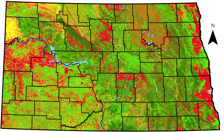
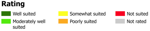
Table 1. Criteria Used to Rate Soils for the Reclamation Suitability Interpretation
| Soil Property and Quality Criteria | Not Suited | Somewhat Suited | Well Suited |
| Site Characteristics | |||
| Slope | ≥ 15% | > 9% AND < 15% | ≤ 9% |
| Slope Aspect | ≥ 130° AND ≤ 270° | (> 90° AND < 130°) AND (> 270° AND < 320°) | (≥ ٠° AND ≤ 90°) AND (≥ 320° AND ≤ 360°) |
| Seasonal High-Water Table | ≤ 50 cm | > 50 cm AND < 75 cm | ≥ 75 cm |
| Slope Shape Morphometry* | ≥ 3.0 | > 0.0 AND < 3.0 | ≤ 0.0 |
| Ponding Frequency* | ≥ 0.7 | > 0.3 AND < 0.7 | ≤ 0.3 |
| Flooding Frequency* | ≥ 0.7 | > 0.4 AND < 0.7 | ≤ 0.4 |
| Surface Fragments | ≥ 3.0 % | > 0.1 % AND < 3.0 % | ≤ 0.1 % |
| Aridity (MAP-PET) | ≤ -254 mm | > -254 mm AND < 0.0 mm | ≥ 0.0 mm |
| Soil Physical Properties | |||
| Available Water Capacity | ≤ 2.54 cm/cm | > 2.54 cm/cm AND < 3.0 cm/cm | ≥ 3.0 cm/cm |
| Organic Matter | ≤ 0.5% | > 0.5% AND < 1.5% | ≥ 1.5% |
| Rooting Depth | ≤ 50 cm | > 50 cm AND < 125 cm | ≥ 125 cm |
| Clay | ≥40% | > 30% AND < 40% | ≤ 30% |
| Stones and Boulders | ≥15% | > 5% AND <15% | ≤ 5% |
| Cobbles | ≥ 50% | > 25% AND < 50% | ≤ 25% |
| Soil Chemical Properties | |||
| Electrical Conductivity | ≥ 6.0 dS/m | > 2.0 dS/m AND < 6.0 dS/m | ≤ 2.0 dS/m |
| Sodium Adsorption Ratio | ≥ 13 | > 5 AND < 13 | ≤ 5 |
| pH | ≤ 4.5 AND ≥ 8.5 | (> 4.5 AND < 5.5) AND (> 7.8 AND < 8.5) | ≥ 5.5 AND ≤ 7.8 |
| Calcium Carbonate Equivalent | ≥ 25% | > 15% AND < 25% | ≤ 15% |
* The respective classes for these qualitative data elements are assigned numerical indices from which the approximate reasoning values are derived.
Table 2. Reclamation Suitability Interpretation: Descriptive and Numerical Classifications
| Suitability Rating | Value |
| Not suited | ≤ 0.000 |
| Poorly suited | > 0.000 AND ≤ 0.333 |
| Somewhat suited | > 0.333 AND ≤ 0.666 |
| Moderately well suited | > 0.666 AND ≤ 0.999 |
| Well suited | ≥ 1.000 |
Soils rated somewhat suited or poorly suited often have features that will limit reclamation success. Soils rated not suited typically have limitations that cannot be easily overcome and often require major offsite additions, special planning or costly installation procedures. Disturbance of these soils is generally not recommended.
Land Preparation
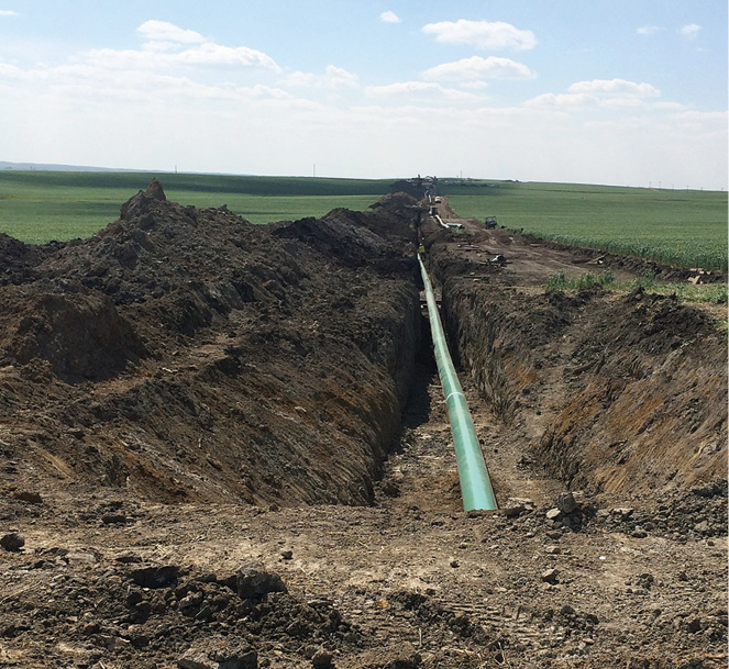
The key to successful reclamation is to minimize the area of disturbance. This will reduce the cost of reclamation, allow adjoining areas to remain intact and help accelerate the recovery process.
Pipeline and Narrow Disturbance
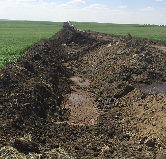
Energy development can have long-term environmental impacts, including soil compaction, mixing of topsoil and subsoil, poor vegetation establishment, increased invasive species and greater runoff. Pipeline disturbances, particularly in croplands, can be identified decades after the disturbance, so take care to follow the appropriate reclamation guidelines from the onset of construction to final recovery to improve reclamation success.
Separate the topsoil from the subsoil.
a. In areas where distinguishing the topsoil from subsoil is difficult, separate the top 8 inches of soil from the rest of the soil and treat it as topsoil. If you are unable to determine the depth of the topsoil, the Web Soil Survey (available online) is a useful tool for providing guidelines for topsoil depth. In all cases, a professional soil classifier can determine the depth of topsoil in the field.
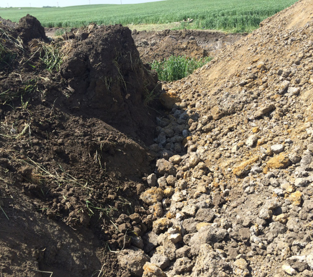
b. Do not mix topsoil and subsoil. Topsoil has biological, physical and chemical properties that are critical for recovery of the site. Mixing topsoil and subsoil decreases organic matter — a loss that can lower soil fertility and water holding capacity, as well as impair soil structure. Some soil nutrients, such as potassium, are reduced during soil mixing, and pH often increases, rendering many other nutrients unavailable for plant uptake. Soil mixing can also alter soil texture by increasing clay content, thereby influencing soil water dynamics. In addition, when mixed, salts in the subsoil increase soil salinity, which can inhibit plant germination, establishment and productivity.
c. Store topsoil separately from the subsoil, either on the opposite side of the trench or with sufficient separation, to prevent the layers from mixing. Subsoil should never be mixed with topsoil. Erosion control measures should be installed to ensure soil stays within the stockpile footprint. If stockpiles are expected to remain for more than a growing season, seed the pile with a cover crop, or seed it with perennial cover if the pile is to be retained for multiple years.
d. If excavating below the subsoil or into different soil horizons, separate this soil from the topsoil and subsoil so it can be backfilled at the base of the trench.
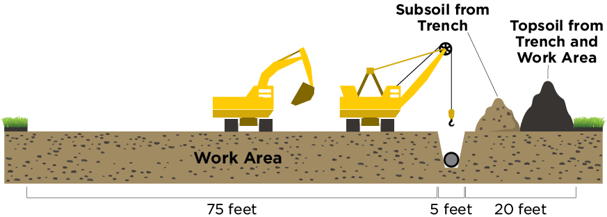
Backfill the soil according to the order in which the layers were removed.
a. Place the subsoil first without compacting the material, but make sure it is firm enough to prevent subsidence of material after reclamation. Water will need to be able to move through this layer, so limiting compaction is key. Subsoil should never be placed over or mixed with topsoil.
b. After the subsoil has been set in the trench, return the topsoil and grade the area to the desired level. Do not mix the topsoil and subsoil.
- A firm seedbed is critical for a successful seeding. Final soil preparation for seeding should provide a firm, relatively uniform seedbed that is not compacted. Loose soil will lead to seed being planted too deeply, resulting in poor vegetative stands, while areas with compaction will lead to shallow rooting and poor plant survival rates. Agricultural practices for seedbed preparation should be used prior to seeding.
Identify areas susceptible to excessive erosion and stabilize them accordingly.
a. See the Erosion Control section of this publication.
Plant an appropriate seed mix for the site; a standard seeding depth for many native grasses is ¼ inch.
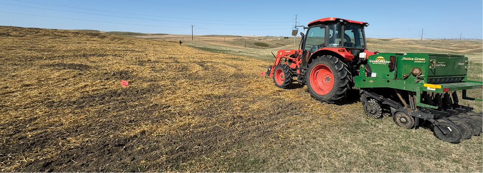
a. Use drills equipped with depth-control bands. Drilling provides the greatest soil-to-seed contact, increasing seeding success
b. Hydroseeding, broadcast and harrowing, or other seeding methods may be used as necessary.
c. Rake seed in around fence lines, meters, stand pipes and other obstructions within the disturbance areas.
d. Use high-quality, clean, conditioned seed that is adapted to the region and has been tested for germination (germ) and purity.
e. Buy seed on a pure live seed (PLS) basis.
f. Calibrate and seed on an adjusted bulk seeding rate of PLS/(germ x purity). For example, if the seeding rate is 10 pounds/acre PLS and your seed has 85% germ and 90% purity, 10/(.85 x .90) = 13.07 bulk pounds/acre.
Non-native grasses and forbs can be invasive on native prairie. Clean equipment thoroughly after seeding non-native species to avoid spreading them to unwanted areas.
Long-term Disturbance Areas such as Pads, Access Roads and Other Construction Areas
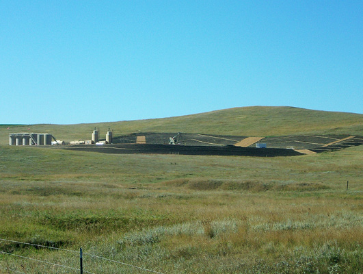
Reclamation projects of these types may not be restored for years or even decades. Over time, these areas often experience long-term soil stockpiling, soil compaction and mixing of topsoil and subsoil resources. Stockpiling can reduce microbial and mycorrhizal fungal activity, disrupting nutrient cycling and, in turn, lowering nutrient availability for plants following reclamation. Organic matter is often reduced in stockpiles, and this decline can diminish soil fertility, limit the soil’s ability to retain moisture and affect overall soil quality. Soil in stockpiles can also become compacted, damaging soil structure. As a result, additional steps may be needed to mitigate these impacts for successful reclamation in the future.
- Strip the topsoil and stockpile it separately for later restoration of the pad, road or other disturbed area. Salvage all topsoil to the depth determined by a professional soil classifier, as it is the most valuable resource for successful reclamation. Topsoil should be stored separately from subsoil and, when possible, in shallow, wide piles. Stockpiles need to be stabilized to avoid erosional losses, even for a short period (less than one month). This can be done by re-establishing native grasses and/or using erosion mats. Retention of topsoil and subsoil resources in stockpiles is essential because topsoil is a nonrenewable resource.
- Bring all slopes, roadways, sediment retainers and ditches to the appropriate grade.
- Backfill the area with subsoil first, then place the topsoil. Subsoil should be firm but not compacted to allow for water movement. Additionally, take care when returning the topsoil to avoid damaging the soil structure. Exercise caution when using scrapers for this process, as this type of equipment can lead to compaction.
- Final preparation for seeding should provide a firm, relatively uniform seedbed. Soil that is too loose increases the risk of seed being planted deeper than intended and can reduce stand establishment. In contrast, excessive compaction can create restrictive layers that limit root development. Use standard agricultural practices to prepare the seedbed.
Identify areas susceptible to excessive erosion and stabilize them accordingly.
a. See the erosion control section of this publication.
Plant an appropriate seed mix for the site; a standard seeding depth for many native grasses is ¼ inch.
a. Use drills equipped with depth-control bands.
b. Hydroseeding, broadcast and harrowing, or other seeding methods may be used as necessary.
c. Use high-quality, clean, conditioned seed that is adapted to the region and has been tested for germination (germ) and purity.
d. Buy and install seed on a pure live seed (PLS) basis.
e. Calibrate and seed on an adjusted bulk seeding rate of PLS/(germ x purity). For example, if the seeding rate is 10 pounds/acre PLS and your seed has 85% germ and 90% purity, 10/(.85 x .90) = 13.07 bulk pounds/acre.
Rangeland and Pasture Seed Mixtures and Rates
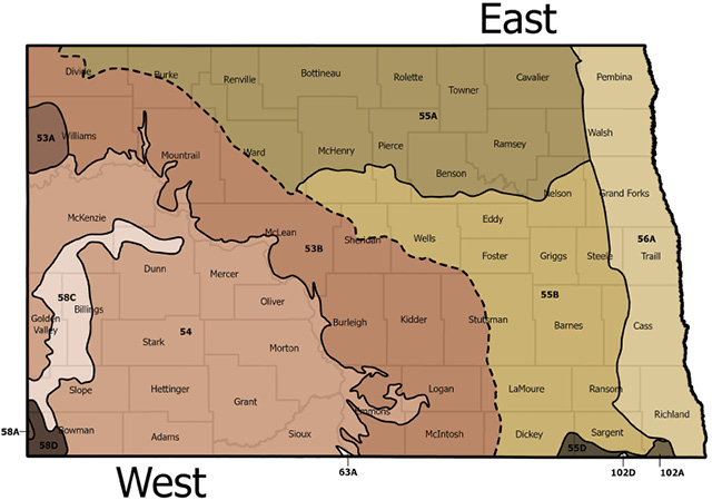
The state was divided into two main areas, East and West, for seed mixture recommendations based on Major Land Resource Areas (MLRAs) (Figure 2). MLRAs are boundaries created by the USDA to guide conservation planning by grouping land with similar characteristics, such as land use, elevation, topography, climate, soil, water, potential natural vegetation and geology. The eastern portion of the state includes MRLAs 55A, 55B, 55D, 56A, 102A and 102D, while the western portion contains MRLA 53A, 53B, 54, 58A, 58C, 58D and 63A. These MLRAs were used to simplify seed mix selection for project managers, reclamation specialists and contractors.
Each side of the state has a recommended native or tame rangeland seed mixture based on the reclamation disturbance response group present. RDRGs are areas with similar soil and plant communities that respond alike when disturbed. They classify land at a scale smaller than MLRAs but build upon ecological site descriptions. ESDs and the RDRGs derived from them share characteristics, such as surface soil depth, texture, available soil moisture, slope and exposure, precipitation, organic matter and soil chemical properties.
For additional information on ecological site descriptions in North Dakota and guidance on identifying ecological sites for management planning, see https://www.ndsu.edu/agriculture/extension/publications/ecological-sites-north-dakota or https://efotg.sc.egov.usda.gov/references/public/ND/Soil_Field_Guide_for_Identifying_Eco_Sites_2.5_2023.pdf.
Ecological sites rated as suitable for reclamation using the Reclamation Suitability interpretation were classified into one of three disturbance response groups: loamy, sandy or marginal. After identifying the ecological sites present in a project area, Table 3 can be used to determine the appropriate disturbance response group(s). A map depicting the disturbance response groups present in North Dakota is shown in Figure 3.
Table 3. Reclamation Disturbance Response Group Classifications and Descriptions
| Reclamation Disturbance Response Group | Ecological Site Description |
| Loamy | Loamy, Loamy overflow, Loamy terrace, Badland fan, Clayey, Limy residual, Limy subirrigated, Shallow clayey, Shallow loamy, Subirrigated, Thin loamy, Very shallow, Thin upland, Clayey overflow, Upland hardwood forest, Loamy savannah, Wet meadow |
| Sandy | Limy sands, Sands, Sandy, Sandy terrace, Shallow sandy, Shallow gravel, Subirrigated sands |
| Marginal1 | Claypan, Sandy claypan, Thin claypan |
1 Marginal sites may also include those ecological sites with saline, sodic or saline-sodic characteristics.
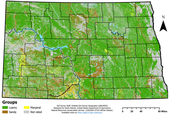
Once the disturbance response groups for the project area have been determined, refer to the appropriate seed mixture tables below for additional information on species and seeding rates for the portion of the state in which the project is located. Tame mixtures include introduced species better suited for fast establishment and forage production, while native mixes include species found in North Dakota’s ecosystem before any invasives or introduced plants arrived. For native loamy and sandy sites, select a minimum of three forbs/legumes from the recommended species list to complement the recommended grass-seeding mixtures. For native marginal sites, select at least one forb species from the list that best fits the area.
Government agencies may have more rigorous restrictions on seed cultivars, origins, seeding dates or other specifications than those listed here. Consult with the appropriate agency before designing or purchasing a seed mixture.
Applying fertilizer to native plant seedings is not recommended. Fertilizers can enhance the growth of exotic grasses such as downy brome, smooth brome and Kentucky bluegrass, as well as annual weeds, which can reduce successful establishment of the seeded area.
Loamy Site Native Seed Mixture
| Plant Species | West* lb/ac PLS1 | East* lb/ac PLS1 |
| Grasses | ||
| Western wheatgrass | 5.6 | 5.0 |
| Green needlegrass | 2.4 | 3.0 |
| Slender wheatgrass | 1.5 | 1.7 |
| Sideoats grama | 2.4 | 3.0 |
| Blue grama | 0.4 | 0.5 |
| Big bluestem | - | 1.5 |
| Forbs | ||
| Purple prairie clover | 0 - 0.4 | 0 - 0.4 |
| Purple coneflower | 0 - 0.9 | 0 - 0.9 |
| Prairie coneflower | 0 - 0.2 | 0 - 0.2 |
| Stiff sunflower | 0 - 0.3 | 0 - 0.3 |
| Maximilian sunflower | 0 - 0.1 | 0 - 0.1 |
* West = MLRAs 53A, 53B, 54, 58A, 58C, 58D, 63A;
East = MLRAs 55A, 55B, 55D, 56A, 102A, 102D
1 PLS = Pure live seed
Loamy Site Tame Seed Mixture
| Plant Species | West* lb/ac PLS1,2 | East* lb/ac PLS1,2 |
| Intermediate/Pubescent wheatgrass | 5 - 17 | 6 - 20 |
| Meadow brome | 8 - 27 | 10 - 33 |
| Crested wheatgrass | 4 - 12 | - |
| Alfalfa | 1 - 11 | 1 - 13 |
* West = MLRAs 53A, 53B, 54, 58A, 58C, 58D, 63A; East = MLRAs 55A, 55B, 55D, 56A, 102A, 102D
1 PLS = Pure live seed
2 Upper levels of seeding rates are based on solid stand if seeded alone; lower ends are based on seeding with a mixture. When alfalfa is part of a mixture, never seed more than 2-3 lb/ac, or it will dominate the stand up to five years after seeding.
Sandy Site Native Seed Mixture
| Plant Species | West* lb/ac PLS1 | East* lb/ac PLS1 |
| Grasses | ||
| Western wheatgrass | 6.4 | 8.0 |
| Canada wildrye | 2.0 | 2.3 |
| Little bluestem | 2.4 | 1.8 |
| Prairie sandreed | 1.2 | 1.5 |
| Blue grama | 0.4 | 0.5 |
| Forbs | ||
| Purple prairie clover | 0 - 0.4 | 0 - 0.4 |
| Purple coneflower | 0 - 0.9 | 0 - 0.9 |
| Prairie coneflower | 0 - 0.2 | 0 - 0.2 |
| Stiff sunflower | 0 - 0.3 | 0 - 0.3 |
| Maximilian sunflower | 0 - 0.1 | 0 - 0.1 |
* West = MLRAs 53A, 53B, 54, 58A, 58C, 58D, 63A; East = MLRAs 55A, 55B, 55D, 56A, 102A, 102D
1 PLS = Pure live seed
Sandy Site Tame Seed Mixture
| Plant Species | West* lb/ac PLS1,2 | East* lb/ac PLS1,2 |
| Intermediate/Pubescent wheatgrass | 5 - 17 | 6 - 20 |
| Meadow brome | 8 - 27 | 10 - 33 |
| Crested wheatgrass | 4 - 12 | - |
| Alfalfa | 1 - 11 | 1 - 13 |
* West = MLRAs 53A, 53B, 54, 58A, 58C, 58D, 63A; East = MLRAs 55A, 55B, 55D, 56A, 102A, 102D
1 PLS = Pure live seed
2 Upper levels of seeding rates are based on solid stand if seeded alone; lower ends are based on seeding with a mixture. When alfalfa is part of a mixture, never seed more than 2-3 lb/ac, or it will dominate the stand up to five years after seeding.
Marginal Site Native Seed Mixture
| Plant Species | West* lb/ac PLS1 | East* lb/ac PLS1 |
| Grasses | ||
| Western wheatgrass | 9.6 | 12.0 |
| Slender wheatgrass | 2.0 | 2.2 |
| Blue grama | 0.8 | 1.0 |
| Forbs | ||
| Western yarrow | 0 - 0.1 | 0 - 0.1 |
| Stiff sunflower | 0 - 0.3 | 0 - 0.3 |
| Lewis flax | 0 - 0.4 | 0 - 0.4 |
| Shrubs | ||
| Wyoming big sagebrush2 | 0.5 - 1 | - |
* West = MLRAs 53A, 53B, 54, 58A, 58C, 58D, 63A; East = MLRAs 55A, 55B, 55D, 56A, 102A, 102D
1 PLS = Pure live seed
2 Plant when reclaiming sites within sage grouse habitat.
Marginal Site Tame Seed Mixture
| Plant Species | West* lb/ac PLS1,3 | East* lb/ac PLS1,3 |
| Western wheatgrass | 1.6 - 16 | 2 - 20 |
| Green wheatgrass | 6 - 20 | 8 - 28 |
| Slender wheatgrass | - | 0 – 2.2 |
| Alfalfa2 | 1 - 11 | 1 - 13 |
* West = MLRAs 53A, 53B, 54, 58A, 58C, 58D, 63A; East = MLRAs 55A, 55B, 55D, 56A, 102A, 102D
1 PLS = Pure live seed
2 Use a salinity-tolerant variety
3 Upper levels of seeding rates are based on solid stand if seeded alone; lower ends are based on seeding with a mixture. When alfalfa is part of a mixture, never seed more than 2-3 lb/ac, or it will dominate the stand up to five years after seeding.
Varieties/Cultivars/Ecovars
| Approved Named Varieties | |
| Species | Recommended Varieties for North Dakota* |
| Introduced Cool-Season Grasses | |
| Crested wheatgrass | |
| Standard | Nordan, RoadCrest, Summit |
| Fairway | Douglas, Ephraim, Fairway, Parkway, Ruff |
| Hybrid | HyCrest, HyCrest II, Nu-ARS AC2 |
| Green wheatgrass | AC Saltlander, NewHy |
| Intermediate wheatgrass | Beefmaker, Chief, Clarke, Haymaker, Manifest, Oahe, Reliant, Rush, Slate |
| Pubescent wheatgrass | Greenleaf, Luna, Manska |
| Meadow brome | Cache, Fleet, Paddock, MacBeth, Montana, Regar |
| Introduced Legumes | |
| Alfalfa1 | Winter Survival Index (WSI) of 2 or less2 and fall dormancy rating of 2 to 5 |
| Native Cool-Season Grasses | |
| Canada wildrye | Mandan |
| Green needlegrass | AC Mallard, Fowler, Lodarm |
| Slender wheatgrass | Adanac, Firststrike, Primar, Pryor, Revenue |
| Western wheatgrass | Flintlock, Recovery, Rodan, Rosana, Walsh, W.R. Poole |
| Native Warm-Season Grasses | |
| Blue grama | Bad River |
| Big bluestem | Bison, Bonilla, Bounty, Champ, Sunnyview |
| Little bluestem | Badlands, Itasca |
| Prairie sandreed | Bowman, Goshen, Koch |
| Sideoats grama | Butte, Killdeer, Pierre |
| Native Forbs/Legumes | |
| Prairie coneflower | Stillwater |
| Purple coneflower | Bismarck |
| Purple prairie clover | Bismarck |
| Lewis flax | Appar, Maple Grove |
| Maximilian sunflower | Medicine Creek |
| Stiff sunflower | Bismarck |
| Western yarrow | Eagle, Great Northern |
| Native Shrubs | |
| Wyoming big sagebrush | Common |
* Origin of varieties not stated (VNS) for native and introduced grass seed is limited to ND, SD, NE, MT, WY, MN and Canada
1 Consult your local Extension agent or agronomist for a list of creeping-type alfalfas that are commonly used for grazing. Alfalfa can cause bloat in livestock when allowed to graze freely.
2 The following website is recommended for use in determining approved alfalfa varieties: https://www.alfalfa.org/. Varieties should have a fall dormancy rating of less than 5 and a winter survival index (WSI) of 2 or less. Note: Alfalfa varieties with a WSI of 2 or 3 may experience some winter kill. The origin of VNS alfalfa types is limited to ND, SD, MN, MT and Canada.
Approved alfalfa varieties that may not be shown on the website include Alogonquin, Anik, Blazer, Champ, Drylander, Grim, Ladak, Ladak 65, Prowler, Rambler, Rangelander, Ramsey, Ranger, Spredor 2, Teton, Travois, Vernal and Wrangler. Alfalfa varieties not listed here or shown on the website will require documentation from the distributor or developer to determine suitability.
Managing Compaction and Soil Moisture
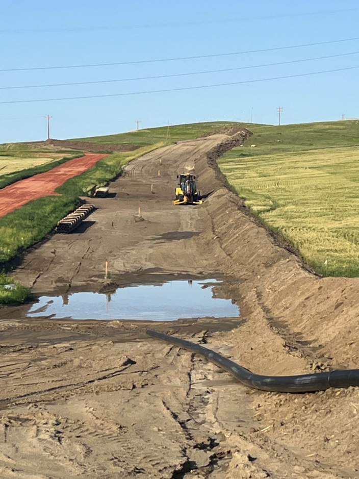
During construction, soil is removed, handled, stored for varying lengths of time and eventually respread. These activities often destroy aggregates, leading to high levels of compaction and increased soil bulk density. Compaction limits water infiltration, decreases soil aeration and increases surface runoff. As bulk density approaches values near 1.7 g/cm³, root growth becomes restricted or may cease entirely. Likewise, soil penetration resistance, another measure of soil compaction, limits root growth at values above 2 MPa (about 300 psi). Common agricultural tillage equipment, such as chisel plows, can be used to disrupt shallow compaction, while deeper compaction may require subsoil ripping to fracture dense layers deeper in the soil profile. In addition, cover crops, particularly those with strong taproots, can help loosen compacted soils over time.
Compaction is more likely to occur when soils are wet, as heavy machinery easily compresses saturated or moist soil. For this reason, construction activities should be avoided during wet periods. Construction during winter or dry conditions is preferred. This is often feasible in western North Dakota, where drought is common.
Reclamation, on the other hand, should occur during wetter periods, as adequate moisture from rainfall or irrigation increases the likelihood of vegetative establishment. Moist soils have lower penetration resistance, allowing roots to more easily penetrate compacted layers even when bulk densities are high. This improves access to water and nutrients, contributing to successful reclamation. Bulk density, penetration resistance, and soil moisture should be measured at the time of seeding to ensure site conditions are favorable. For management practices that can aid in retaining soil moisture and support establishment during reclamation, see the Erosion Control section.
Erosion Control
During construction, the destruction of soil structure and lack of vegetative cover increase soil susceptibility to erosion. The establishment of plants helps stabilize soil by promoting aggregate formation and improving water infiltration, lessening erosion from wind and water. Topsoil and subsoil stockpiles must also be protected from erosional processes, even if the duration of stockpiling is short (less than one month). This protection is especially important when resources are stored for extended periods. Erosion control practices may be needed when reclamation occurs outside preferred seeding windows or when site topography requires additional measures to support successful restoration.
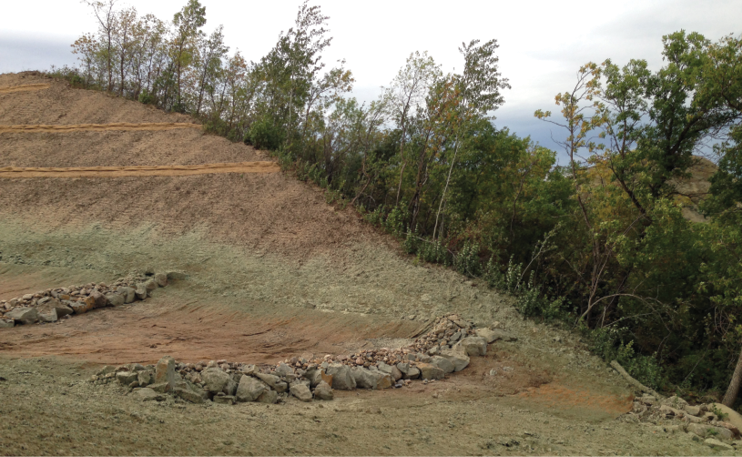
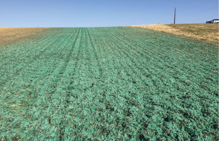
Spray-on covers such as hydromulch can help stabilize disturbed soils, reduce evaporation, promote germination and control erosion. Germination can be enhanced initially, as soil moisture beneath hydromulch is often higher due to the water added during installation. However, NDSU research has shown that hydromulch, with its sealing ability, can act hydrophobically, causing water to run off more quickly and in larger quantities than bare soil in some years. Since this water does not infiltrate, soil moisture beneath the mulch can be lower following rainfall events. While hydromulch may increase runoff early on, it generally reduces the amount of sediment carried in that runoff.
As the mulch breaks down, the sealing effect diminishes, allowing infiltration to improve over time while still protecting the soil surface. Hydroseeding, which applies seed and hydrated mulch together, has been used successfully to establish native vegetation, especially on sloped areas. However, this practice is often expensive and requires substantial amounts of water.
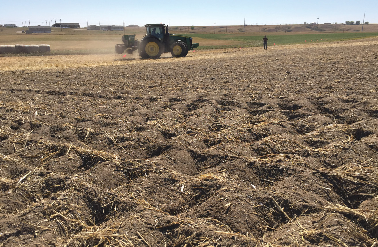
Stabilizing soil with straw or mulch, including crimping with wheat, barley or oat straw, can help control erosion by reducing the impact of raindrops and overland flow. This surface cover slows water movement across soil, allowing more water to infiltrate while also helping keep seed in place. NDSU studies have shown that straw crimping can delay the onset of runoff and reduce the overall volume of runoff compared with bare soil, although results can vary by year. While straw cover does not consistently reduce sediment loads in runoff, it still provides several important benefits for reclamation.
Straw cover can also limit evaporation, helping retain soil moisture needed for successful plant establishment. Another benefit of straw and other mulch materials is their potential to increase organic matter over time, improving soil structure. These high-carbon materials can slow organic matter decomposition, temporarily limiting nutrients such as nitrogen that might otherwise aid the growth and competitiveness of undesirable or invasive species.
Land imprinting, a practice in which shallow impressions are pressed into the soil surface, can help retain soil, seeds, plant residues and water on disturbed areas such as rights-of-way. These impressions promote water retention and infiltration near the seed, enhancing establishment success. Imprinting may also help break soil crusts, allowing for better gas exchange. While this practice has been effective in arid environments, experiments evaluating land imprinting in North Dakota have not shown any added benefits.
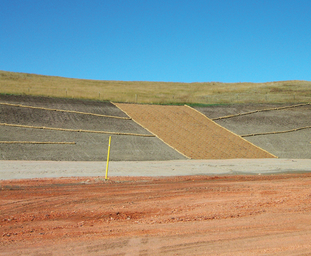
In some situations, surface treatments alone may not be sufficient to control erosion. Additional measures, such as erosion control mats, may be needed on steeper slopes or in remote areas where access is limited. Often, the area being protected is not the only factor influencing erosion. If a disturbed site is affected by runoff from the surrounding landscape, other controls, such as temporary berms, diversions or sediment fences, may be required to redirect large sheet flows away from the site. Many erosion-control methods are available, so effective erosion management requires evaluating the landscape as a whole and using the controls best suited to the site.
Construction projects in North Dakota that disturb one acre or more, or less than one acre that are part of a larger development plan, are required to obtain a construction storm water permit under the North Dakota Pollutant Discharge Elimination System (NDPDES) Program. Under this permit, operators must develop and implement a Stormwater Pollution Prevention Plan (SWPPP) that includes best management practices (BMPs) designed to reduce soil erosion, sediment transport and other pollutants in stormwater runoff during construction. For additional information on permitting requirements and state regulations, refer to the North Dakota Department of Environmental Quality Division of Water Quality: https://deq.nd.gov/WQ/2_NDPDES_Permits/8_Stormwater/StW.aspx.
Determining Reclamation Success
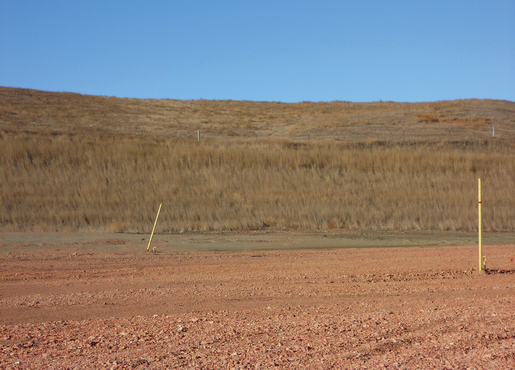
Disturbed areas should be monitored over time and compared with adjacent, similar reference areas to document revegetation success. If revegetation is successful, soil structure and function are also likely to have recovered to levels that support long-term, desirable vegetative communities.
Developing and following a long-term monitoring plan is important for identifying and addressing potential problems early. Direct monitoring and comparison with suitable reference areas will ensure that landowner commitments, both private and public, are met and that all applicable regulatory requirements are satisfied.
While monitoring the reclamation process, identify any areas of instability or erosion. Uncontrolled wind and water erosion can rapidly degrade a reclamation project, destroying the integrity of the land and the quality of water downslope. If erosion points are identified and appear to be worsening, incorporate control measures that slow and divert runoff and minimize wind-driven losses.
Erosion control best management practices that may be incorporated include successful stands of vegetation, wattles, silt fences, straw bales and trenches. Wind erosion is more difficult to evaluate than water erosion; however, where water erosion control practices are implemented, wind erosion is also likely to be reduced.
Pay close attention to topsoil and subsoil replacement depths. Replacement depths can be evaluated using a soil auger to identify changes in soil color, as topsoil is typically darker than underlying layers.
As vegetation becomes established, annual weeds may still occur during the first and second growing seasons. Noxious weeds must be controlled by pulling or spraying before they spread or produce seed, as required by law.
Seedlings from the seeded mixtures should be noticeable during the first growing season, and by the second growing season, seeded plants should be present throughout the site. A common standard for successful revegetation is achieving three to five established plants of replacement vegetation per square foot, as specified in the seed mixture or compared with adjacent undisturbed areas.
Reclaiming lands disturbed by energy development requires careful planning and site-specific management. Developing and following a reclamation plan will help to minimize the disturbance footprint and guide activities from construction through revegetation. Separating and conserving topsoil and subsoil resources, selecting site-appropriate seed mixtures, and implementing effective erosion control are foundational steps that support the long-term recovery of disturbed areas and the reestablishment of stable plant communities and ecological functions. By following the practices outlined in this publication, disturbed lands can be restored to conditions that meet both landowner expectations and regulatory requirements.
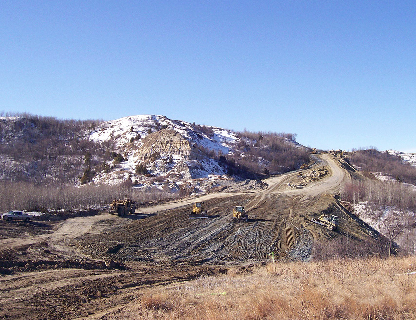
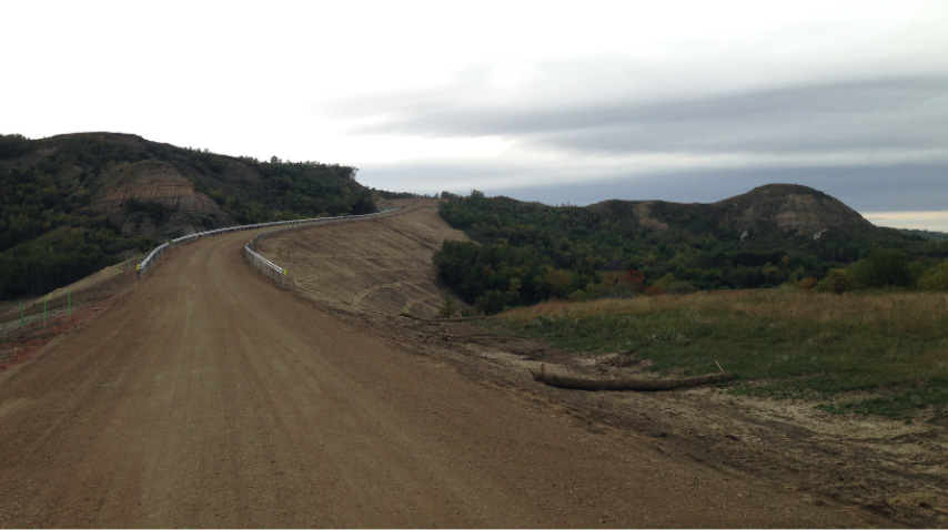
All photos used with permission from Brenda Rettinger (Marathon Oil) or Amanda Jenkins (ONEOK) or provided by the authors of this publication.
