Weather Forecast (06/02/22)
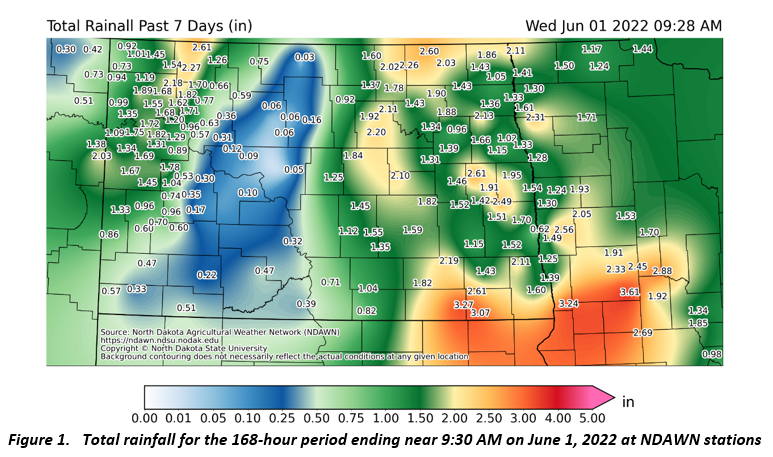
As was expected, rainfall these past 7 days was widespread and locally heavy. Parts of central North Dakota were mostly missed, but elsewhere 1” plus rain was common with some localized heavy rain in excess of 2.5 inches being recorded (Figure 1). Most areas will see little if any rain until early next week with no big storms foreseen during this forecast period.
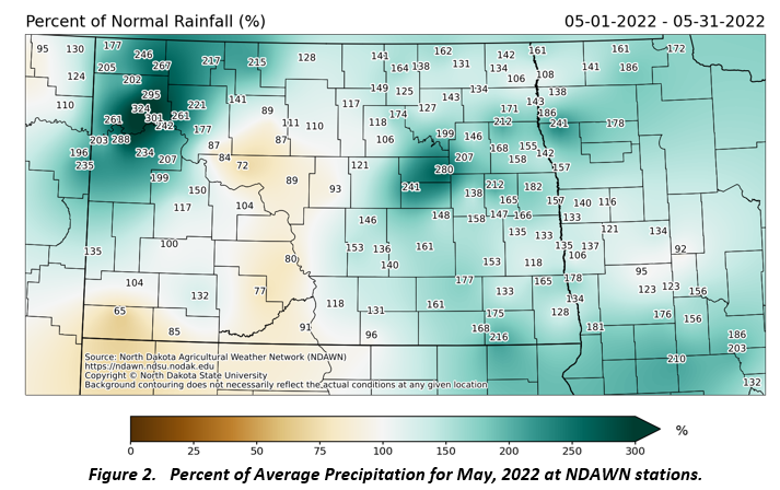
The Memorial Day weekend rain pushed most of the region to above average precipitation for the month (Figure 2). Even through May 29, only about 50% of the state of North Dakota recorded near or even below average rain for the month, but the widespread heavier rain on Memorial Day pushed a high percentage of the state to above or well above normal for May. June 1 marks the first day of summer for climatological statistics. Thus, the rain on the last few days of May moved Fargo into the Top 10 wettest springs on record (March 1 through May 31). Fargo’s official weather site ended up recording the 9th wettest spring on record and Grand Forks (UND records) ended up with the 3rd wettest spring on record.
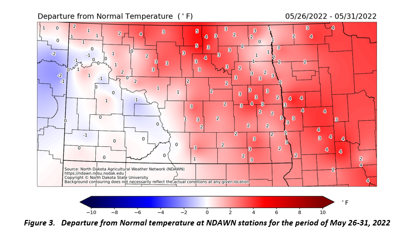
Temperatures this past week were near or even a bit above average. The data from yesterday, June 1 was not included in Figure 3. If June 1 had been included, most locations would have had temperatures closer to average. These next 7 days will be mostly below average. These below average temperatures will mean minimums in the 30s or 40s on most mornings. Plus, there may be a risk of frost on some mornings, with northern North Dakota areas the most prone.
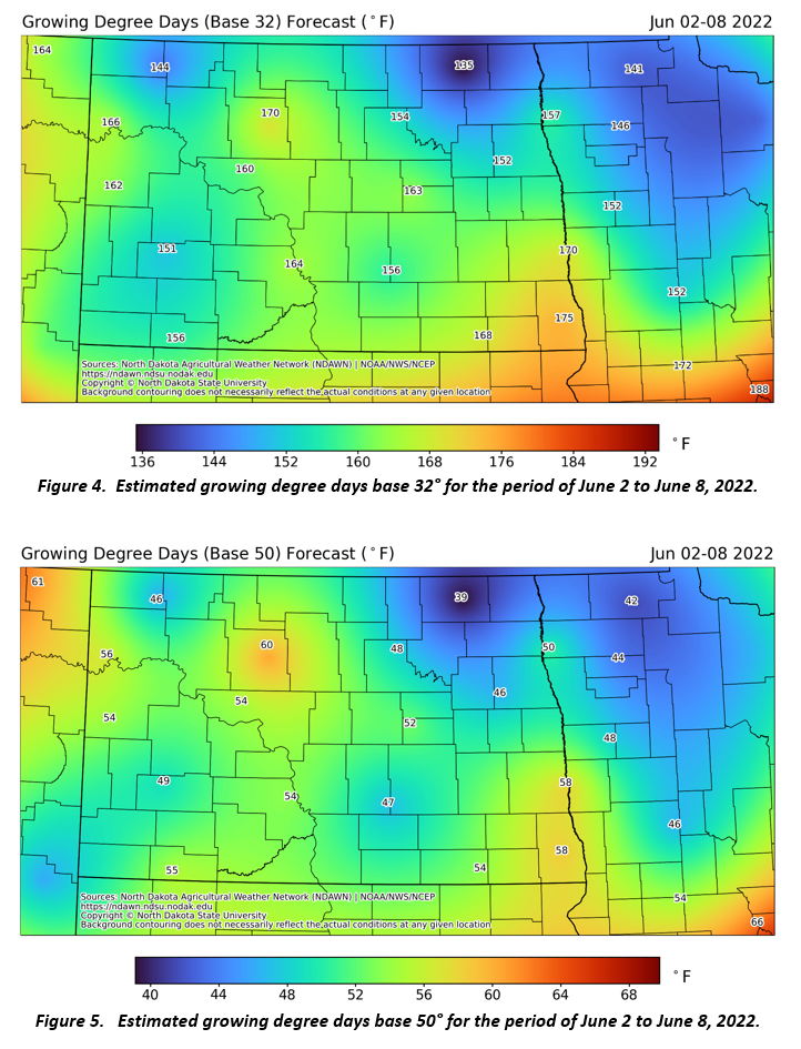
Figures 4 and 5 below are forecasted estimates of Growing Degree Days (GDDs) base 32° (wheat and small grains) and 50° (Corn and Soybeans). The number of GDDs in the next week should be noticably below average.
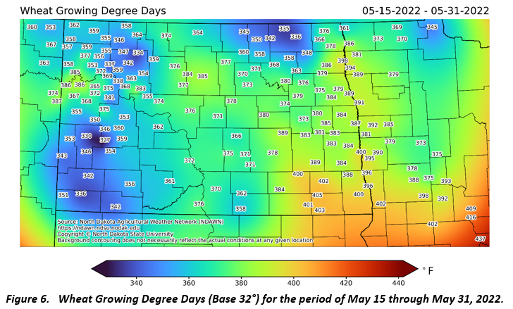
Using May 15 as a planting date, the accumulated growing degree days for wheat (base temperature 32°) are given in Figure 6. You can calculate wheat growing degree days based on your exact planting date(s) here: https://ndawn.ndsu.nodak.edu/wheat-growing-degree-days.html
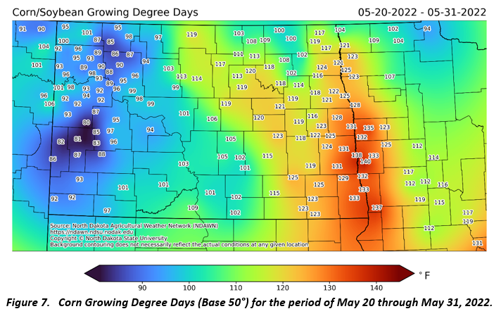
Using May 20 as a planting date, the accumulated growing degree days for corn (base temperature 50°) are given in Figure 7. You can calculate corn growing degree days based on your exact planting date(s) here: https://ndawn.ndsu.nodak.edu/corn-growing-degree-days.html.