Using Web-based Mapping to Manage CREC Trials

As technology behind cloud-computing and internet-based geographic information systems (GIS) has evolved, there is also an opportunity to use these technologies for managing and serving the information we collect as it pertains to our agricultural fields. Many of us are aware of the online cadastral (survey) maps that provide current information for state, county, and municipal constituents, but in an internet-based mapping application, such as ArcGIS Online, we can rapidly access data associated with trials using our mobile devices and access current information on treatments, crop type, and status such as crop development. For agricultural producers, technologies such as these provide rapid access to field-based data and can allow updating based on field observations. We decided to use internet-based mapping to manage information pertaining to our trials. The following describes the process.
The first step to implementing the web maps was to ensure that the field and trial data were up-to-date in the GIS (Figure 1).
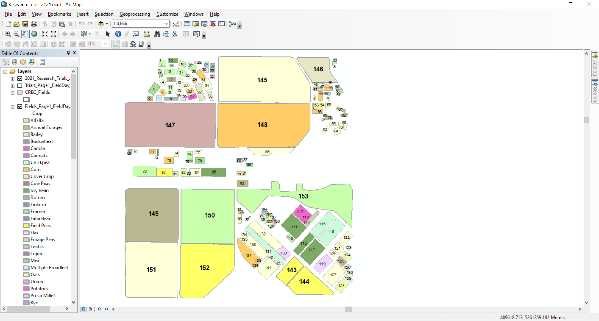
CREC staff determined field and trial boundaries for the 2021 field season. After spatial information for 2021 was created, those data were migrated into an online GIS environment. For this application we utilized ArcGIS Online (AGOL) (www.arcgis.com) and our NDSU organizational account. It is important to note that anyone can access a free AGOL account and use those services with zero overhead.
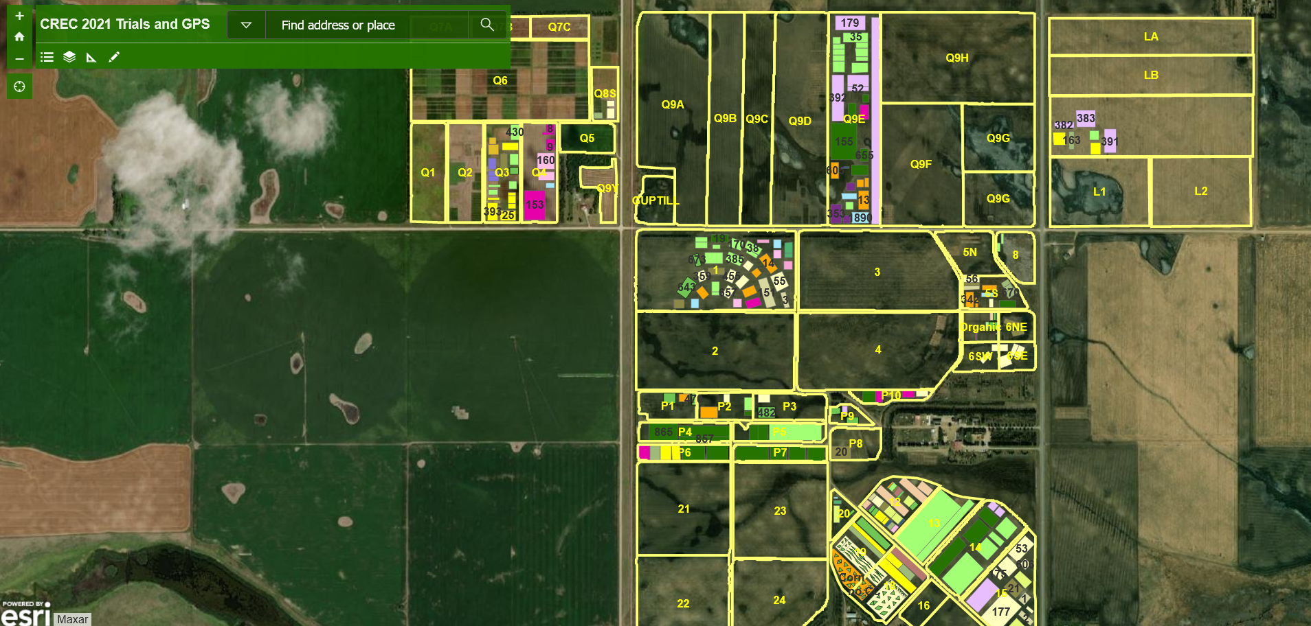
Once the data were compiled, the geometry was checked and then uploaded to AGOL to implement the web-based mapping application. A template available in AGOL allows users to search based on field or trial identifier, make measurements, and turn the legend on or off (Figure 2).
The amount of information that can be obtained is related to the amount of information that is associated with each of the fields/trials (Figure 3).
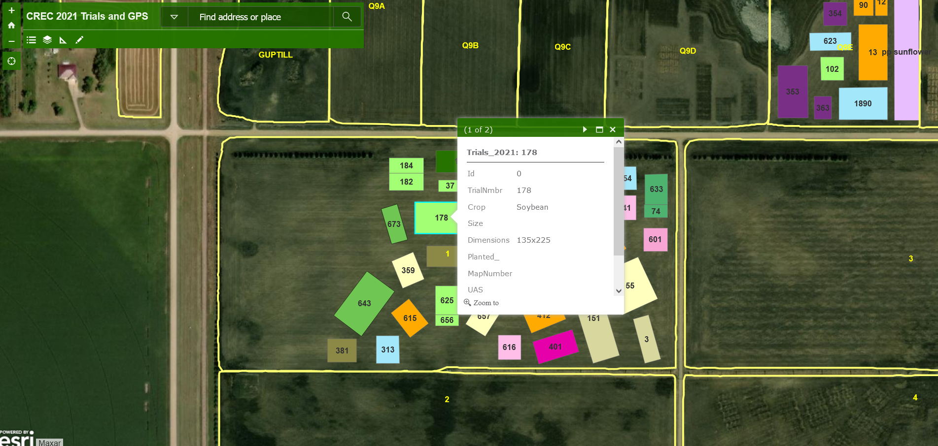
In a perfect world, that would include crop type, treatments, sUAS flights, and historical data so that we can better understand long term trends in productivity or crop response to a treatment.
The ability to access web-based maps offers numerous advantages over traditional paper maps. The first, and likely largest benefit, is that information is available on mobile devices nearly instantaneously. Second, over time there will be a reduced reliance on paper, and third, web-based maps offer the opportunity to integrate additional layers such as plot corners and recently collected imagery.
David Kramar, Ph. D.
Precision Agriculture Specialist
David.Kramar@ndsu.edu