Weather Forecast (05/19/22)
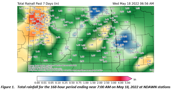
Most of the rain that fell in the past 7 days occurred late last week, on Thursday May 12 and Friday May 13 (Figure 1). Much of the rain that falls in the next 7 days will also occur on a Thursday (today) and Friday. Total rain should be lower, in most locations, yet any amount of rain will continue to keep the area wet. In fact, even snow may fall over the area, especially on Friday. The pattern over North America has made a noticeable shift, and the issue comes with the time of year. We are entering the wettest time of the year, so it is difficult to go a week or more with no precipitation in late May into June. Once the precipitation from today (Thursday) and tomorrow moves on, like this past week, moisture will be more hit and miss this weekend into next week.
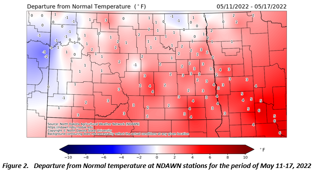
It may not have felt like it, but the period from May 11 through May 17 finished with above average temperatures for much of the region (Figure 2). That will not be the case for the next 7 days. It will be turning very cold for the time of year, on Friday through the weekend. Frost (36°) or a Freeze (32°) will be likely on Saturday and Sunday morning. A hard freeze (28°) will be possible in lower areas that are often colder. Because of the late or no planting to this point, these freezing temperatures should have minimal impacts outside of homeowners and others that have more sensitive plants outside.
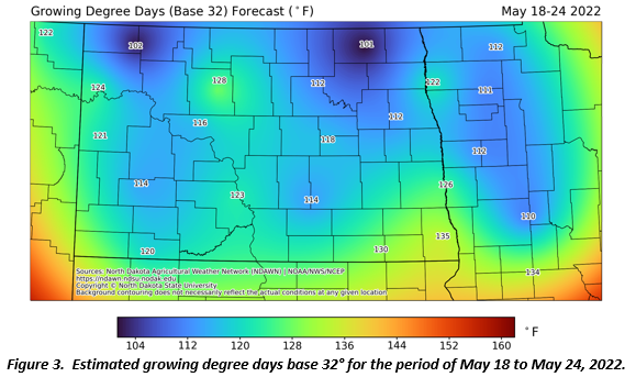
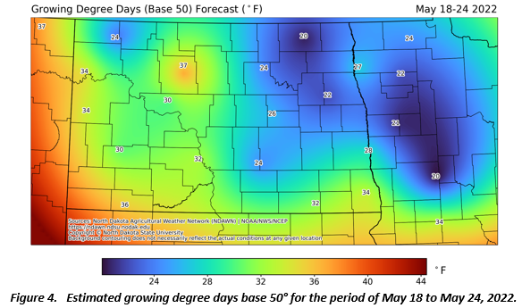
Figures 3 and 4 below are forecasted estimates of Growing Degree Days (GDDs) base 32° (wheat and small grains) and 50° (Corn and Soybeans). Because of the cooler temperatures moving into the area, very few GDDs are expected in this period and most of what is recorded will occur next week.
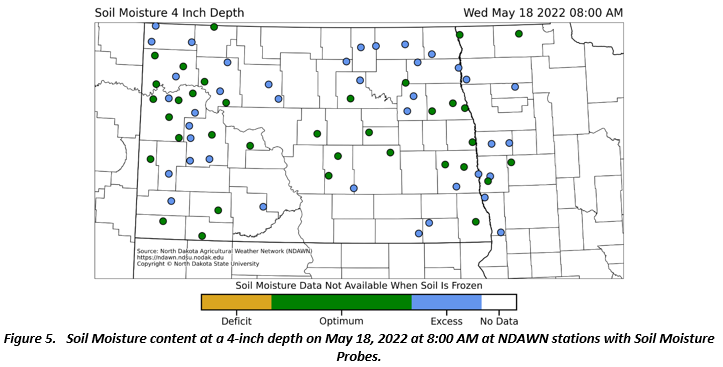
Almost one-half of NDAWN (North Dakota Agricultural Weather Network) stations now have soil moisture probes in place. These probes are placed at the standard depths of 2”, 4”, 8”, 20” and 40”. The NDAWN staff is scheduled to install soil moisture probes at an additional 25 stations this summer. No surprise that all stations have either excess or high optimal water in the top several inches of the soil. (Figure 5).